Property Information
mobile view
| Serial Number: 53:610:0001 |
Serial Life: 2021... |
|
|
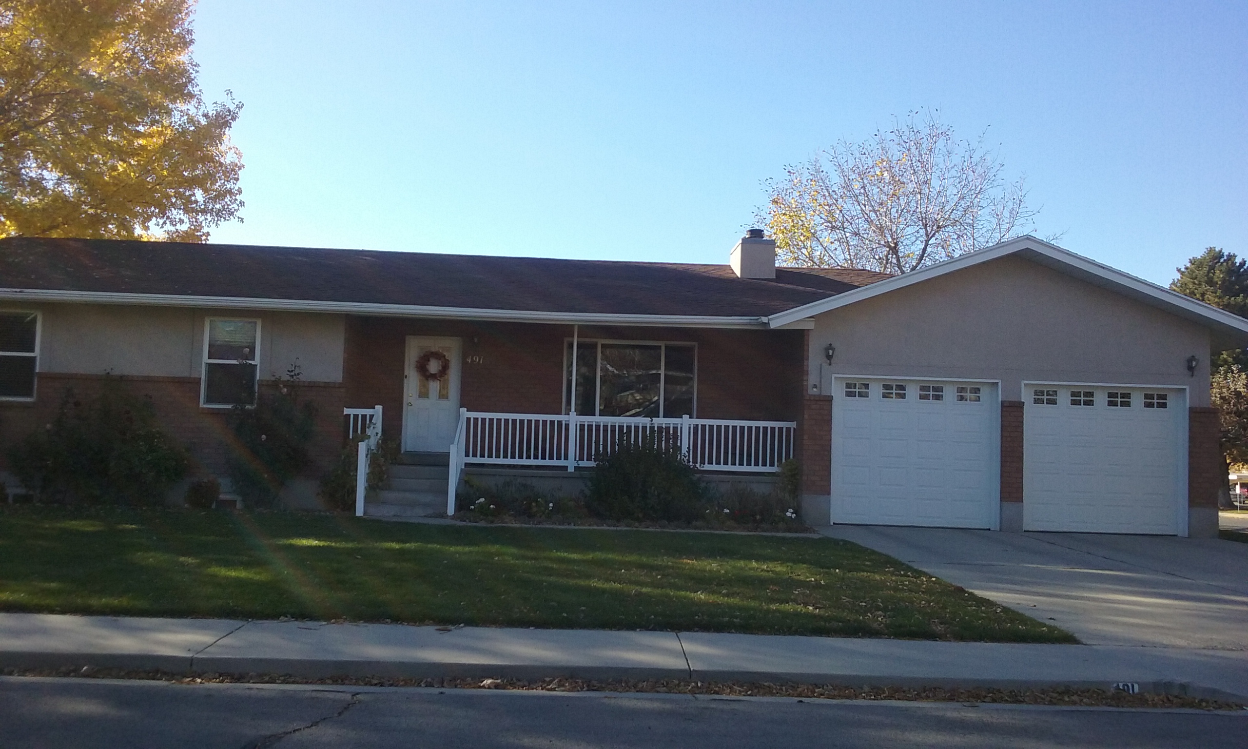 Total Photos: 1
|
| |
|
|
| Property Address: 491 N 450 WEST - OREM |
|
| Mailing Address: 491 N 450 W OREM, UT 84057-3784 |
|
| Acreage: 0.401484 |
|
| Last Document:
195461-2020
|
|
| Subdivision Map Filing |
|
| Taxing Description:
LOT 1, PLAT B, THOMASVILLE SUB AREA 0.401 AC.
*Taxing description NOT FOR LEGAL DOCUMENTS
|
|
- Owner Names
- Value History
- Tax History
- Location
- Photos
- Documents
- Aerial Image
| |
----- Real Estate Values ----- |
---Improvements--- |
---Greenbelt--- |
Total |
| Year |
Com |
Res |
Agr |
Tot |
Com |
Res |
Agr |
Tot |
Land |
Homesite |
Tot |
Market Value |
| 2024 |
$0 |
$212,100 |
$0 |
$212,100 |
$0 |
$379,100 |
$0 |
$379,100 |
$0 |
$0 |
$0 |
$591,200 |
| 2023 |
$0 |
$212,100 |
$0 |
$212,100 |
$0 |
$380,000 |
$0 |
$380,000 |
$0 |
$0 |
$0 |
$592,100 |
| 2022 |
$0 |
$226,100 |
$0 |
$226,100 |
$0 |
$323,800 |
$0 |
$323,800 |
$0 |
$0 |
$0 |
$549,900 |
| 2021 |
$0 |
$133,000 |
$0 |
$133,000 |
$0 |
$299,800 |
$0 |
$299,800 |
$0 |
$0 |
$0 |
$432,800 |
| Year |
General Taxes |
Adjustments |
Net Taxes |
Fees |
Payments |
Tax Balance* |
Balance Due |
Tax District |
| 2025 |
$0.00 |
$0.00 |
$0.00 |
$0.00 |
|
$0.00
|
$0.00 |
090 - OREM CITY |
| 2024 |
$2,659.16 |
$0.00 |
$2,659.16 |
$0.00 |
|
|
Click for Payoff
|
090 - OREM CITY |
| 2023 |
$2,477.91 |
$0.00 |
$2,477.91 |
$0.00 |
|
$0.00
|
$0.00 |
090 - OREM CITY |
| 2022 |
$2,375.40 |
$0.00 |
$2,375.40 |
$0.00 |
|
$0.00
|
$0.00 |
090 - OREM CITY |
| 2021 |
$2,244.24 |
$0.00 |
$2,244.24 |
$0.00 |
|
$0.00
|
$0.00 |
090 - OREM CITY |
* Note: Original tax amount (Does not include applicable interest and/or fees).
| Entry # |
Date |
Recorded |
Type |
Party1 (Grantor) |
Party2 (Grantee) |
| 12623-2021 |
01/22/2021 |
01/22/2021 |
QCD |
THOMAS, JEANNINE A TEE (ET AL) |
THOMAS, JEANNINE A TEE (ET AL) |
| 195461-2020 |
11/03/2020 |
12/08/2020 |
S PLAT |
THOMAS, JEANNINE A TEE (ET AL) |
THOMASVILLE PLAT B |
Main Menu Comments or Concerns on Value/Appraisal - Assessor's Office
Documents/Owner/Parcel information - Recorder's Office
Address Change for Tax Notice
This page was created on 10/14/2024 3:53:25 PM |