Property Information
mobile view
| Serial Number: 54:433:0021 |
Serial Life: 2024... |
|
|
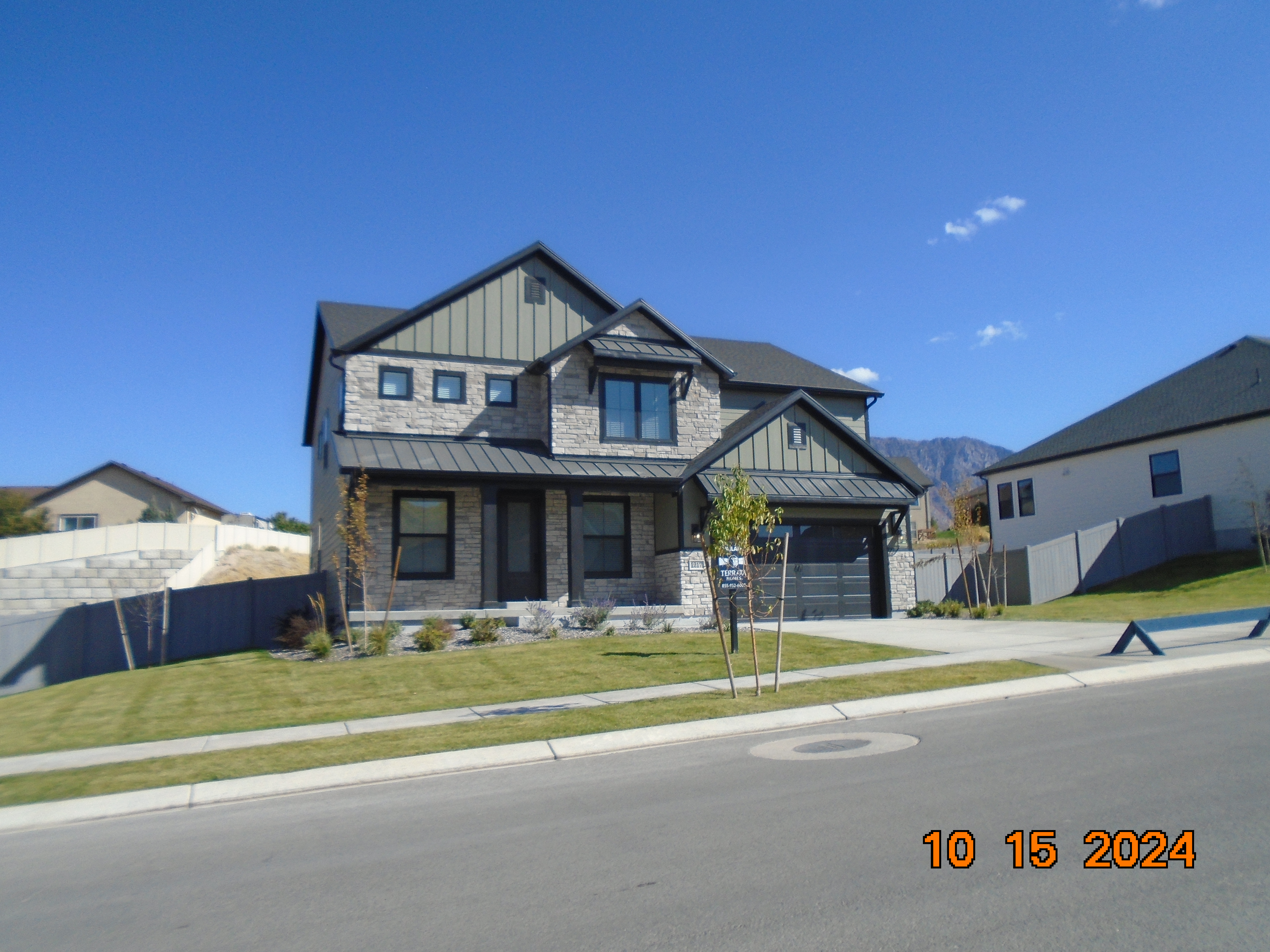 Total Photos: 1
|
| |
|
|
| Property Address: 1217 S CREST DALE LN - SANTAQUIN |
|
| Mailing Address: 1450 LAKE ROBBINS DR # 430 THE WOODLANDS, TX 77380 |
|
| Acreage: 0.328745 |
|
| Last Document:
38722-2023
|
|
| Subdivision Map Filing |
|
| Taxing Description:
LOT 21, THE VISTAS WEST @ SUMMIT RIDGE PHASE 1 SUB AREA 0.329 AC.
*Taxing description NOT FOR LEGAL DOCUMENTS
|
|
- Owner Names
- Value History
- Tax History
- Location
- Photos
- Documents
- Aerial Image
| |
----- Real Estate Values ----- |
---Improvements--- |
---Greenbelt--- |
Total |
| Year |
Com |
Res |
Agr |
Tot |
Com |
Res |
Agr |
Tot |
Land |
Homesite |
Tot |
Market Value |
| 2025 |
$0 |
$136,900 |
$0 |
$136,900 |
$0 |
$423,800 |
$0 |
$423,800 |
$0 |
$0 |
$0 |
$560,700 |
| 2024 |
$0 |
$130,400 |
$0 |
$130,400 |
$0 |
$0 |
$0 |
$0 |
$0 |
$0 |
$0 |
$130,400 |
| Year |
General Taxes |
Adjustments |
Net Taxes |
Fees |
Payments |
Tax Balance* |
Balance Due |
Tax Area |
| 2026 |
$0.00 |
$0.00 |
$0.00 |
$0.00 |
|
$0.00
|
$0.00 |
190 - SANTAQUIN CITY |
| 2025 |
$0.00 |
$0.00 |
$0.00 |
$0.00 |
|
$0.00
|
$0.00 |
190 - SANTAQUIN CITY |
| 2024 |
$1,309.48 |
$0.00 |
$1,309.48 |
$0.00 |
|
$0.00
|
$0.00 |
190 - SANTAQUIN CITY |
* Note: Original tax amount (Does not include applicable interest and/or fees).
| Entry # |
Date |
Recorded |
Type |
Party1 (Grantor) |
Party2 (Grantee) |
| 38722-2023 |
05/16/2023 |
06/15/2023 |
S PLAT |
LGI HOMES - UTAH LLC |
VISTAS WEST @ SUMMIT RIDGE THE PHASE 1 |
Main Menu Comments or Concerns on Value/Appraisal - Assessor's Office
Documents/Owner/Parcel information - Recorder's Office
Address Change for Tax Notice
This page was created on 7/23/2025 7:45:20 AM |