Property Information
mobile view
| Serial Number: 55:815:0126 |
Serial Life: 2017... |
|
|
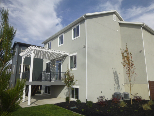
Total Photos: 1
|
| |
|
|
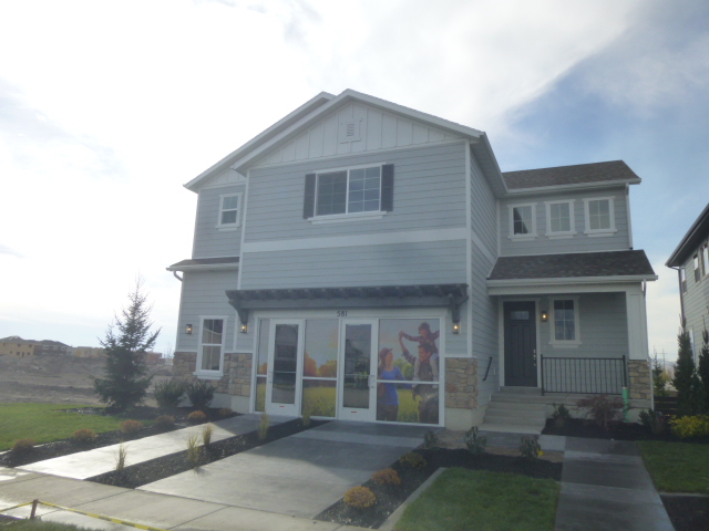
| Property Address: 581 N 100 EAST - VINEYARD |
|
| Mailing Address: 581 N 100 E VINEYARD, UT 84059 |
|
| Acreage: 0.123904 |
|
| Last Document:
71003-2018
|
|
| Subdivision Map Filing |
|
| Taxing Description:
LOT 126, PLAT B, WATERS EDGE, PHASE 5 SUB AREA 0.124 AC.
*Taxing description NOT FOR LEGAL DOCUMENTS
|
|
- Owner Names
- Value History
- Tax History
- Location
- Photos
- Documents
- Aerial Image
| |
----- Real Estate Values ----- |
---Improvements--- |
---Greenbelt--- |
Total |
| Year |
Com |
Res |
Agr |
Tot |
Com |
Res |
Agr |
Tot |
Land |
Homesite |
Tot |
Market Value |
| 2024 |
$0 |
$205,300 |
$0 |
$205,300 |
$0 |
$362,800 |
$0 |
$362,800 |
$0 |
$0 |
$0 |
$568,100 |
| 2023 |
$0 |
$205,200 |
$0 |
$205,200 |
$0 |
$382,200 |
$0 |
$382,200 |
$0 |
$0 |
$0 |
$587,400 |
| 2022 |
$0 |
$218,800 |
$0 |
$218,800 |
$0 |
$348,300 |
$0 |
$348,300 |
$0 |
$0 |
$0 |
$567,100 |
| 2021 |
$0 |
$156,300 |
$0 |
$156,300 |
$0 |
$267,900 |
$0 |
$267,900 |
$0 |
$0 |
$0 |
$424,200 |
| 2020 |
$0 |
$142,100 |
$0 |
$142,100 |
$0 |
$255,100 |
$0 |
$255,100 |
$0 |
$0 |
$0 |
$397,200 |
| 2019 |
$0 |
$132,600 |
$0 |
$132,600 |
$0 |
$240,800 |
$0 |
$240,800 |
$0 |
$0 |
$0 |
$373,400 |
| 2018 |
$0 |
$120,000 |
$0 |
$120,000 |
$0 |
$228,900 |
$0 |
$228,900 |
$0 |
$0 |
$0 |
$348,900 |
| 2017 |
$0 |
$101,100 |
$0 |
$101,100 |
$0 |
$215,500 |
$0 |
$215,500 |
$0 |
$0 |
$0 |
$316,600 |
| Year |
General Taxes |
Adjustments |
Net Taxes |
Fees |
Payments |
Tax Balance* |
Balance Due |
Tax District |
| 2025 |
$0.00 |
$0.00 |
$0.00 |
$0.00 |
|
$0.00
|
$0.00 |
095 - VINEYARD CITY |
| 2024 |
$0.00 |
$0.00 |
$0.00 |
$0.00 |
|
$0.00
|
$0.00 |
095 - VINEYARD CITY |
| 2023 |
$3,082.41 |
$0.00 |
$3,082.41 |
$0.00 |
|
$0.00
|
$0.00 |
095 - VINEYARD CITY |
| 2022 |
$3,061.04 |
$0.00 |
$3,061.04 |
$0.00 |
|
$0.00
|
$0.00 |
095 - VINEYARD CITY |
| 2021 |
$2,715.73 |
$0.00 |
$2,715.73 |
$0.00 |
|
$0.00
|
$0.00 |
095 - VINEYARD CITY |
| 2020 |
$2,545.28 |
$0.00 |
$2,545.28 |
$0.00 |
|
$0.00
|
$0.00 |
095 - VINEYARD CITY |
| 2019 |
$2,322.12 |
$0.00 |
$2,322.12 |
$0.00 |
|
$0.00
|
$0.00 |
095 - VINEYARD CITY |
| 2018 |
$2,360.50 |
$0.00 |
$2,360.50 |
$0.00 |
|
$0.00
|
$0.00 |
095 - VINEYARD CITY |
| 2017 |
$2,185.51 |
$0.00 |
$2,185.51 |
$0.00 |
|
$0.00
|
$0.00 |
095 - VINEYARD CITY |
* Note: Original tax amount (Does not include applicable interest and/or fees).
| Entry # |
Date |
Recorded |
Type |
Party1 (Grantor) |
Party2 (Grantee) |
| 23863-2024 |
04/10/2024 |
04/12/2024 |
D TR |
ALE, TYLER & TIFFANY |
LOAN STORE INC THE |
| 23845-2024 |
04/10/2024 |
04/12/2024 |
WD |
WALLACE, BONNIE TEE (ET AL) |
ALE, TYLER & TIFFANY |
| 25127-2020 |
01/16/2020 |
02/27/2020 |
ADECCOV |
FLAGSHIP DEVELOPMENT INC |
WHOM OF INTEREST |
| 128813-2019 |
12/04/2019 |
12/05/2019 |
WD |
WALLACE, BONNIE SUCTEE (ET AL) |
WALLACE, BONNIE TEE (ET AL) |
| 128812-2019 |
11/04/2019 |
12/05/2019 |
AF DC |
MORTON, JOHN DALY DEC (ET AL) |
WALLACE, BONNIE SUCTEE (ET AL) |
| 71003-2018 |
07/26/2018 |
07/30/2018 |
SP WD |
WOODSIDE HOMES OF UTAH LLC |
WALLACE, BONNIE TEE (ET AL) |
| 42583-2016 |
05/09/2016 |
05/13/2016 |
REC |
VANCE, DWAYNE A TEE |
VERTICAL DEVELOPMENT LLC |
| 15618-2016 |
02/24/2016 |
02/25/2016 |
S PLAT |
WOODSIDE HOMES OF UTAH LLC |
WATER'S EDGE PHASE 5 PLAT B |
Main Menu Comments or Concerns on Value/Appraisal - Assessor's Office
Documents/Owner/Parcel information - Recorder's Office
Address Change for Tax Notice
This page was created on 8/3/2024 10:03:20 AM |