Property Information
mobile view
| Serial Number: 65:315:0001 |
Serial Life: 2009... |
|
|
 Total Photos: 2
|
| |
|
|
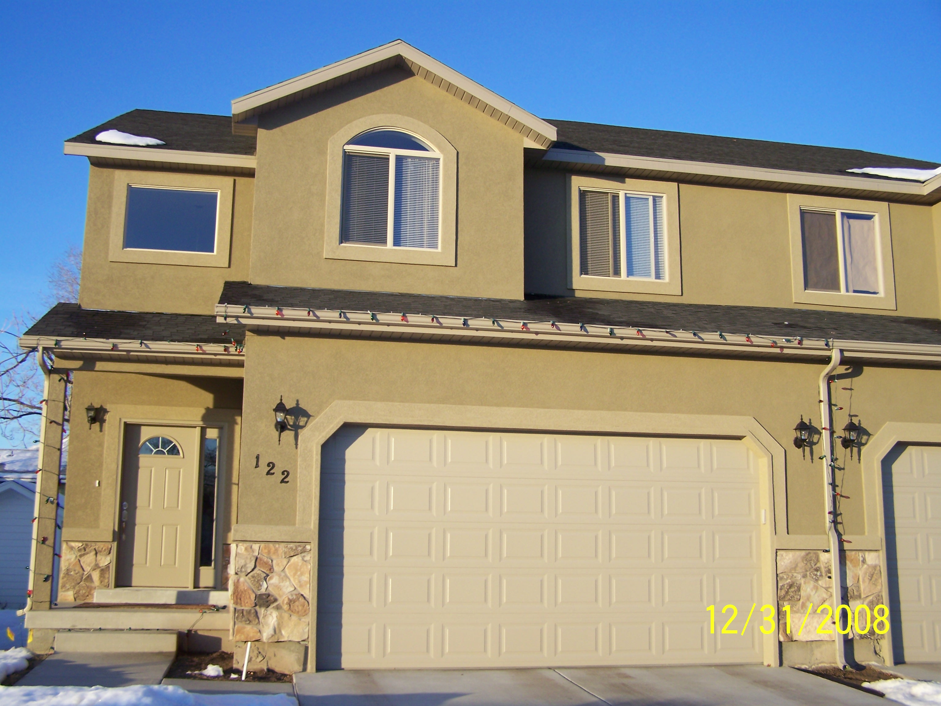
| Property Address: 122 W 975 NORTH - OREM |
|
| Mailing Address: %ALVORD, AMY 279 W 570 N LINDON, UT 84062 |
|
| Acreage: 0.031 |
|
| Last Document:
118686-2008
|
|
| Subdivision Map Filing |
|
| Taxing Description:
UNIT 1, CHELSEA COURT CONDOMINIUMS. AREA 0.031 AC.
*Taxing description NOT FOR LEGAL DOCUMENTS
|
|
- Owner Names
- Value History
- Tax History
- Location
- Photos
- Documents
- Aerial Image
| |
----- Real Estate Values ----- |
---Improvements--- |
---Greenbelt--- |
Total |
| Year |
Com |
Res |
Agr |
Tot |
Com |
Res |
Agr |
Tot |
Land |
Homesite |
Tot |
Market Value |
| 2024 |
$0 |
$64,600 |
$0 |
$64,600 |
$0 |
$374,600 |
$0 |
$374,600 |
$0 |
$0 |
$0 |
$439,200 |
| 2023 |
$0 |
$63,000 |
$0 |
$63,000 |
$0 |
$365,500 |
$0 |
$365,500 |
$0 |
$0 |
$0 |
$428,500 |
| 2022 |
$0 |
$39,100 |
$0 |
$39,100 |
$0 |
$351,600 |
$0 |
$351,600 |
$0 |
$0 |
$0 |
$390,700 |
| 2021 |
$0 |
$36,800 |
$0 |
$36,800 |
$0 |
$269,600 |
$0 |
$269,600 |
$0 |
$0 |
$0 |
$306,400 |
| 2020 |
$0 |
$32,800 |
$0 |
$32,800 |
$0 |
$240,700 |
$0 |
$240,700 |
$0 |
$0 |
$0 |
$273,500 |
| 2019 |
$0 |
$32,000 |
$0 |
$32,000 |
$0 |
$231,000 |
$0 |
$231,000 |
$0 |
$0 |
$0 |
$263,000 |
| 2018 |
$0 |
$32,000 |
$0 |
$32,000 |
$0 |
$231,000 |
$0 |
$231,000 |
$0 |
$0 |
$0 |
$263,000 |
| 2017 |
$0 |
$26,000 |
$0 |
$26,000 |
$0 |
$195,300 |
$0 |
$195,300 |
$0 |
$0 |
$0 |
$221,300 |
| 2016 |
$0 |
$26,000 |
$0 |
$26,000 |
$0 |
$166,400 |
$0 |
$166,400 |
$0 |
$0 |
$0 |
$192,400 |
| 2015 |
$0 |
$26,000 |
$0 |
$26,000 |
$0 |
$159,000 |
$0 |
$159,000 |
$0 |
$0 |
$0 |
$185,000 |
| 2014 |
$0 |
$26,000 |
$0 |
$26,000 |
$0 |
$159,000 |
$0 |
$159,000 |
$0 |
$0 |
$0 |
$185,000 |
| 2013 |
$0 |
$26,000 |
$0 |
$26,000 |
$0 |
$149,000 |
$0 |
$149,000 |
$0 |
$0 |
$0 |
$175,000 |
| 2012 |
$0 |
$26,000 |
$0 |
$26,000 |
$0 |
$149,000 |
$0 |
$149,000 |
$0 |
$0 |
$0 |
$175,000 |
| 2011 |
$0 |
$26,000 |
$0 |
$26,000 |
$0 |
$149,000 |
$0 |
$149,000 |
$0 |
$0 |
$0 |
$175,000 |
| 2010 |
$0 |
$31,000 |
$0 |
$31,000 |
$0 |
$189,600 |
$0 |
$189,600 |
$0 |
$0 |
$0 |
$220,600 |
| 2009 |
$0 |
$31,000 |
$0 |
$31,000 |
$0 |
$193,000 |
$0 |
$193,000 |
$0 |
$0 |
$0 |
$224,000 |
| Year |
General Taxes |
Adjustments |
Net Taxes |
Fees |
Payments |
Tax Balance* |
Balance Due |
Tax District |
| 2025 |
$0.00 |
$0.00 |
$0.00 |
$0.00 |
|
$0.00
|
$0.00 |
090 - OREM CITY |
| 2024 |
$1,975.48 |
$0.00 |
$1,975.48 |
$0.00 |
|
$0.00
|
$0.00 |
090 - OREM CITY |
| 2023 |
$1,793.25 |
$0.00 |
$1,793.25 |
$0.00 |
|
$0.00
|
$0.00 |
090 - OREM CITY |
| 2022 |
$1,687.71 |
$0.00 |
$1,687.71 |
$0.00 |
|
$0.00
|
$0.00 |
090 - OREM CITY |
| 2021 |
$1,588.81 |
$0.00 |
$1,588.81 |
$0.00 |
|
$0.00
|
$0.00 |
090 - OREM CITY |
| 2020 |
$1,443.03 |
$0.00 |
$1,443.03 |
$0.00 |
|
$0.00
|
$0.00 |
090 - OREM CITY |
| 2019 |
$1,334.40 |
$0.00 |
$1,334.40 |
$0.00 |
|
$0.00
|
$0.00 |
090 - OREM CITY |
| 2018 |
$1,396.60 |
$0.00 |
$1,396.60 |
$0.00 |
|
$0.00
|
$0.00 |
090 - OREM CITY |
| 2017 |
$1,206.56 |
$0.00 |
$1,206.56 |
$0.00 |
|
$0.00
|
$0.00 |
090 - OREM CITY |
| 2016 |
$1,137.57 |
$0.00 |
$1,137.57 |
$0.00 |
|
$0.00
|
$0.00 |
090 - OREM CITY |
| 2015 |
$1,156.59 |
$0.00 |
$1,156.59 |
$0.00 |
|
$0.00
|
$0.00 |
090 - OREM CITY |
| 2014 |
$1,161.88 |
$0.00 |
$1,161.88 |
$0.00 |
|
$0.00
|
$0.00 |
090 - OREM CITY |
| 2013 |
$1,185.22 |
$0.00 |
$1,185.22 |
$0.00 |
|
$0.00
|
$0.00 |
090 - OREM CITY |
| 2012 |
$1,209.67 |
$0.00 |
$1,209.67 |
$0.00 |
|
$0.00
|
$0.00 |
090 - OREM CITY |
| 2011 |
$1,203.90 |
$0.00 |
$1,203.90 |
$0.00 |
|
$0.00
|
$0.00 |
090 - OREM CITY |
| 2010 |
$1,420.77 |
$0.00 |
$1,420.77 |
$0.00 |
|
$0.00
|
$0.00 |
090 - OREM CITY |
| 2009 |
$1,337.34 |
$0.00 |
$1,337.34 |
$0.00 |
|
$0.00
|
$0.00 |
090 - OREM CITY |
* Note: Original tax amount (Does not include applicable interest and/or fees).
| Entry # |
Date |
Recorded |
Type |
Party1 (Grantor) |
Party2 (Grantee) |
| 200340-2020 |
12/04/2020 |
12/16/2020 |
WD |
KNAPP, CHRISTOPHER (ET AL) |
PENGUIN PROPERTIES LLC |
| 72283-2016 |
07/22/2016 |
08/03/2016 |
REC |
BANK OF AMERICAN FORK TEE |
KNAPP, CHRISTOPHER (ET AL) |
| 115127-2013 |
12/11/2013 |
12/19/2013 |
REC |
BANK OF AMERICAN FORK TEE |
ALVORD, KELLY D |
| 112002-2013 |
12/06/2013 |
12/09/2013 |
D TR |
KNAPP, CHRISTOPHER (ET AL) |
BANK OF AMERICAN FORK |
| 112001-2013 |
12/06/2013 |
12/09/2013 |
WD |
ALVORD, KELLY D |
KNAPP, CHRISTOPHER (ET AL) |
| 123007-2008 |
|
11/18/2008 |
CONSENT |
CITY OF OREM |
WHOM OF INTEREST |
| 118687-2008 |
11/03/2008 |
11/04/2008 |
DECLCON |
ALVORD, KELLY D |
WHOM OF INTEREST |
| 118686-2008 |
10/01/2008 |
11/04/2008 |
C PLAT |
ALVORD, KELLY & AMY |
CHELSEA COURT CONDOMINIUMS |
Main Menu Comments or Concerns on Value/Appraisal - Assessor's Office
Documents/Owner/Parcel information - Recorder's Office
Address Change for Tax Notice
This page was created on 4/18/2025 5:56:48 PM |
