Property Information
mobile view
| Serial Number: 65:672:0002 |
Serial Life: 2022... |
|
|
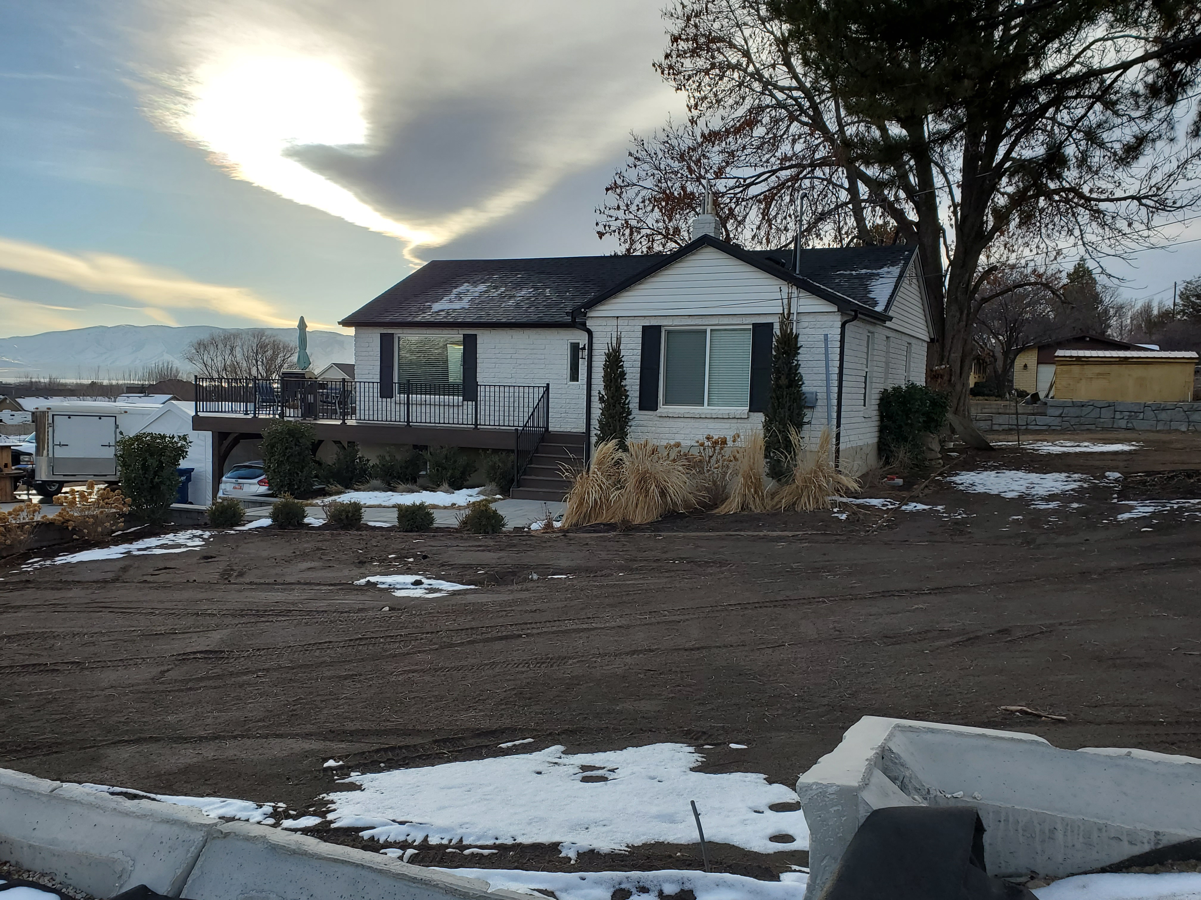 Total Photos: 1
|
| |
|
|
| Property Address: 911 W 2600 NORTH - PLEASANT GROVE |
|
| Mailing Address: 1138 W 2480 N PLEASANT GROVE, UT 84062 |
|
| Acreage: 0.499771 |
|
| Last Document:
167206-2021
|
|
| Subdivision Map Filing |
|
| Taxing Description:
LOT 2, PLAT A, COOKS HOLLOW SUB AREA 0.500 AC.
*Taxing description NOT FOR LEGAL DOCUMENTS
|
|
- Owner Names
- Value History
- Tax History
- Location
- Photos
- Documents
- Aerial Image
| |
----- Real Estate Values ----- |
---Improvements--- |
---Greenbelt--- |
Total |
| Year |
Com |
Res |
Agr |
Tot |
Com |
Res |
Agr |
Tot |
Land |
Homesite |
Tot |
Market Value |
| 2024 |
$0 |
$262,500 |
$0 |
$262,500 |
$0 |
$193,500 |
$0 |
$193,500 |
$0 |
$0 |
$0 |
$456,000 |
| 2023 |
$0 |
$262,400 |
$0 |
$262,400 |
$0 |
$191,800 |
$0 |
$191,800 |
$0 |
$0 |
$0 |
$454,200 |
| 2022 |
$0 |
$276,800 |
$0 |
$276,800 |
$0 |
$233,500 |
$0 |
$233,500 |
$0 |
$0 |
$0 |
$510,300 |
| Year |
General Taxes |
Adjustments |
Net Taxes |
Fees |
Payments |
Tax Balance* |
Balance Due |
Tax District |
| 2025 |
$0.00 |
$0.00 |
$0.00 |
$0.00 |
|
$0.00
|
$0.00 |
070 - PLEASANT GROVE CITY |
| 2024 |
$2,149.11 |
$0.00 |
$2,149.11 |
$0.00 |
|
$0.00
|
$0.00 |
070 - PLEASANT GROVE CITY |
| 2023 |
$2,044.69 |
($47.46) |
$1,997.23 |
$0.00 |
|
$0.00
|
$0.00 |
070 - PLEASANT GROVE CITY |
| 2022 |
$2,308.75 |
$0.00 |
$2,308.75 |
$0.00 |
|
$0.00
|
$0.00 |
070 - PLEASANT GROVE CITY |
* Note: Original tax amount (Does not include applicable interest and/or fees).
| Entry # |
Date |
Recorded |
Type |
Party1 (Grantor) |
Party2 (Grantee) |
| 62393-2023 |
09/06/2023 |
09/21/2023 |
EAS |
COOK, JULIE LARSON TEE (ET AL) |
NICKELL, KENNETH M TEE (ET AL) |
| 167206-2021 |
09/28/2021 |
09/28/2021 |
S PLAT |
COOK, GREGORY PAUL & JULIE LARSON TEE (ET AL) |
COOKS HOLLOW PLAT A |
Main Menu Comments or Concerns on Value/Appraisal - Assessor's Office
Documents/Owner/Parcel information - Recorder's Office
Address Change for Tax Notice
This page was created on 2/26/2025 1:56:04 AM |