Property Information
mobile view
| Serial Number: 66:544:0017 |
Serial Life: 2017-2024 |
|
|
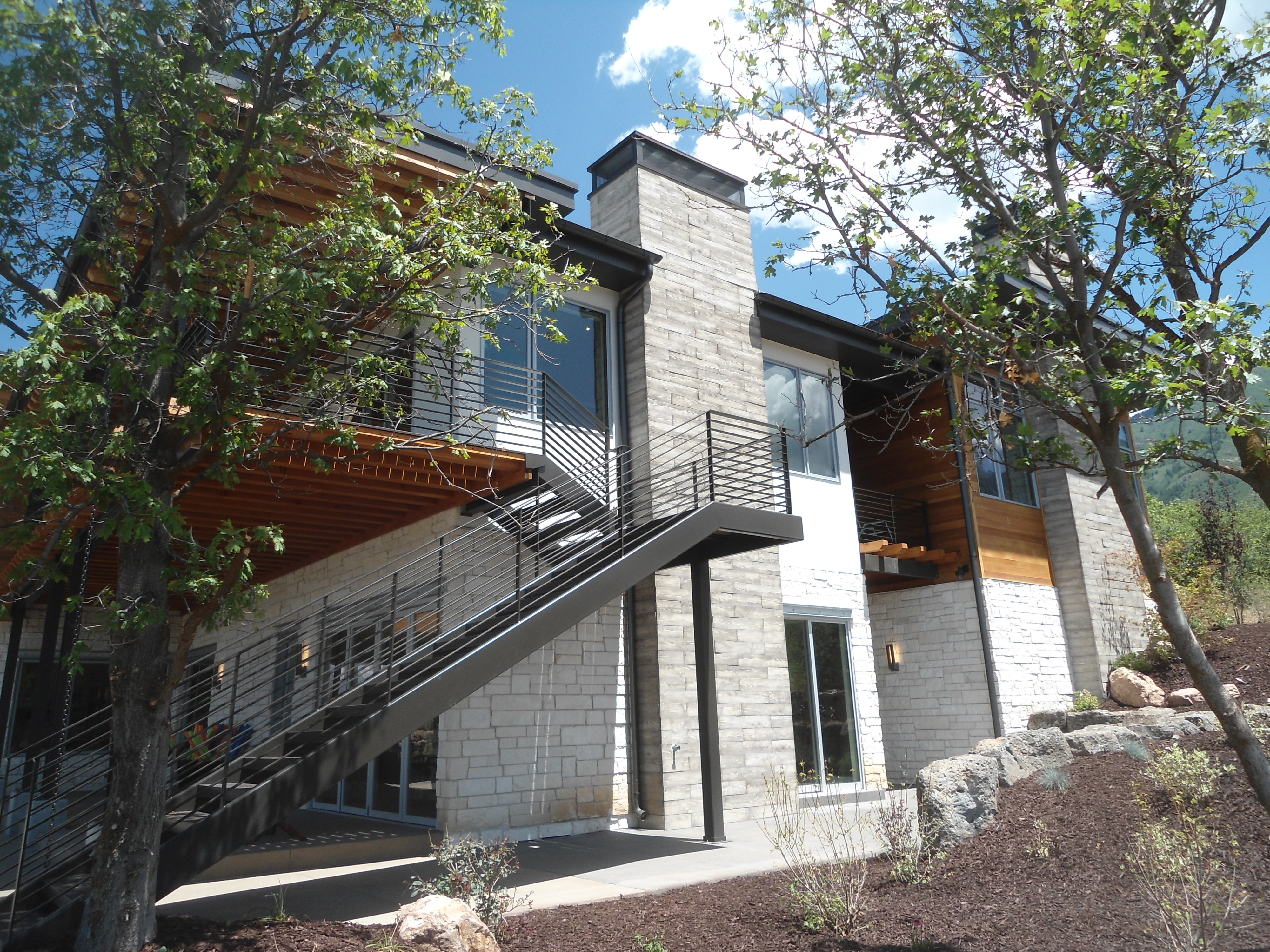 Total Photos: 1
|
| |
|
|
| Property Address: 772 S SUMMIT CREEK DR - WOODLAND HILLS |
|
| Mailing Address: 5742 W HAROLD GATTY DR SALT LAKE CITY, UT 84116 |
|
| Acreage: 0.502103 |
|
| Last Document:
214997-2021
|
|
| Subdivision Map Filing |
|
| Taxing Description:
LOT 17, PLAT B, SUMMIT CREEK 7 AMD SUB AREA 0.502 AC.
*Taxing description NOT FOR LEGAL DOCUMENTS
|
|
- Owner Names
- Value History
- Tax History
- Location
- Photos
- Documents
- Aerial Image
| |
----- Real Estate Values ----- |
---Improvements--- |
---Greenbelt--- |
Total |
| Year |
Com |
Res |
Agr |
Tot |
Com |
Res |
Agr |
Tot |
Land |
Homesite |
Tot |
Market Value |
| 2024 |
$0 |
$319,400 |
$0 |
$319,400 |
$0 |
$1,956,100 |
$0 |
$1,956,100 |
$0 |
$0 |
$0 |
$2,275,500 |
| 2023 |
$0 |
$310,100 |
$0 |
$310,100 |
$0 |
$1,942,500 |
$0 |
$1,942,500 |
$0 |
$0 |
$0 |
$2,252,600 |
| 2022 |
$0 |
$311,200 |
$0 |
$311,200 |
$0 |
$2,249,800 |
$0 |
$2,249,800 |
$0 |
$0 |
$0 |
$2,561,000 |
| 2021 |
$0 |
$270,600 |
$0 |
$270,600 |
$0 |
$1,744,000 |
$0 |
$1,744,000 |
$0 |
$0 |
$0 |
$2,014,600 |
| 2020 |
$0 |
$235,300 |
$0 |
$235,300 |
$0 |
$1,645,300 |
$0 |
$1,645,300 |
$0 |
$0 |
$0 |
$1,880,600 |
| 2019 |
$0 |
$235,300 |
$0 |
$235,300 |
$0 |
$1,430,700 |
$0 |
$1,430,700 |
$0 |
$0 |
$0 |
$1,666,000 |
| 2018 |
$0 |
$184,800 |
$0 |
$184,800 |
$0 |
$1,244,100 |
$0 |
$1,244,100 |
$0 |
$0 |
$0 |
$1,428,900 |
| 2017 |
$0 |
$184,800 |
$0 |
$184,800 |
$0 |
$1,081,800 |
$0 |
$1,081,800 |
$0 |
$0 |
$0 |
$1,266,600 |
| Year |
General Taxes |
Adjustments |
Net Taxes |
Fees |
Payments |
Tax Balance* |
Balance Due |
Tax District |
| 2024 |
$27,201.33 |
$0.00 |
$27,201.33 |
$0.00 |
|
$0.00
|
$0.00 |
182 - WOODLAND HILLS |
| 2023 |
$27,114.55 |
$0.00 |
$27,114.55 |
$0.00 |
|
$0.00
|
$0.00 |
182 - WOODLAND HILLS |
| 2022 |
$30,680.78 |
$0.00 |
$30,680.78 |
$0.00 |
|
$0.00
|
$0.00 |
182 - WOODLAND HILLS |
| 2021 |
$28,911.52 |
$0.00 |
$28,911.52 |
$0.00 |
|
$0.00
|
$0.00 |
182 - WOODLAND HILLS |
| 2020 |
$15,200.51 |
$0.00 |
$15,200.51 |
$0.00 |
|
$0.00
|
$0.00 |
182 - WOODLAND HILLS |
| 2019 |
$13,141.57 |
$0.00 |
$13,141.57 |
$0.00 |
|
$0.00
|
$0.00 |
182 - WOODLAND HILLS |
| 2018 |
$11,584.09 |
$0.00 |
$11,584.09 |
$0.00 |
|
$0.00
|
$0.00 |
182 - WOODLAND HILLS |
| 2017 |
$10,644.51 |
$0.00 |
$10,644.51 |
$0.00 |
|
$0.00
|
$0.00 |
182 - WOODLAND HILLS |
* Note: Original tax amount (Does not include applicable interest and/or fees).
| Entry # |
Date |
Recorded |
Type |
Party1 (Grantor) |
Party2 (Grantee) |
| 71897-2024 |
06/11/2024 |
10/17/2024 |
S PLAT |
PANTHERA DEVELOPMENT LLC (ET AL) |
SUMMIT CREEK 7 PLAT G-4 |
| 32146-2024 |
05/15/2024 |
05/15/2024 |
DECL |
NORTHERN SLOPE LLC (ET AL) |
WHOM OF INTEREST |
| 59131-2023 |
09/07/2023 |
09/07/2023 |
WD |
SUMMIT CREEK HOMEOWNERS ASSOCIATION INC |
PANTHERA DEVELOPMENT LLC |
| 214997-2021 |
12/30/2021 |
12/30/2021 |
WD |
PANTHERA DEVELOPMENT LLC FKA (ET AL) |
SUMMIT CREEK HOMEOWNERS ASSOCIATION INC |
| 197207-2021 |
11/10/2021 |
11/24/2021 |
DECL |
NORTHERN SLOPE LLC (ET AL) |
WHOM OF INTEREST |
| 177292-2021 |
10/12/2021 |
10/18/2021 |
DECLCOV |
NORTHERN SLOPE LLC (ET AL) |
WHOM OF INTEREST |
| 113108-2019 |
10/31/2019 |
10/31/2019 |
ADECCOV |
PANTHERA DEVELOPMENT LLC |
WHOM OF INTEREST |
| 103797-2016 |
04/28/2015 |
10/18/2016 |
S PLAT |
LYONS GATE LLC (ET AL) |
SUMMIT CREEK 7 PLAT B AMD |
Main Menu Comments or Concerns on Value/Appraisal - Assessor's Office
Documents/Owner/Parcel information - Recorder's Office
Address Change for Tax Notice
This page was created on 2/18/2025 2:39:11 AM |