Property Information
mobile view
| Serial Number: 66:559:0001 |
Serial Life: 2018... |
|
|
 Total Photos: 17
|
| |
|
|
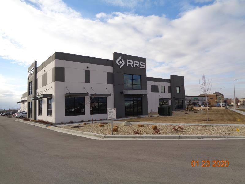
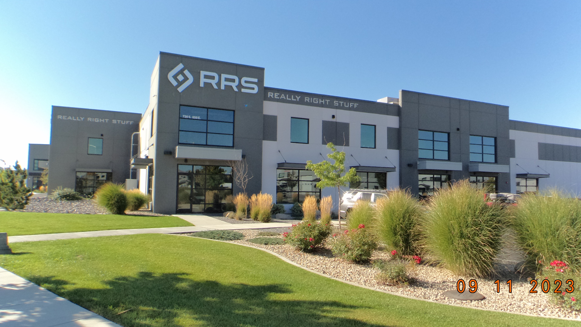
| Property Address: 720 S MILLPOND RD - LEHI
more see "Addrs" tab below..
|
|
| Mailing Address: 15689 S FAIR WINN CT DRAPER, UT 84020 |
|
| Acreage: 2.118786 |
|
| Last Document:
8684-2018
|
|
| Subdivision Map Filing |
|
| Taxing Description:
LOT 1, S&S INDUSTRIAL PARK SUB AREA 2.119 AC.
*Taxing description NOT FOR LEGAL DOCUMENTS
|
|
- Owner Names
- Value History
- Tax History
- Location
- Photos
- Documents
- Aerial Image
- Addrs
| |
----- Real Estate Values ----- |
---Improvements--- |
---Greenbelt--- |
Total |
| Year |
Com |
Res |
Agr |
Tot |
Com |
Res |
Agr |
Tot |
Land |
Homesite |
Tot |
Market Value |
| 2024 |
$905,100 |
$0 |
$0 |
$905,100 |
$6,182,400 |
$0 |
$0 |
$6,182,400 |
$0 |
$0 |
$0 |
$7,087,500 |
| 2023 |
$885,000 |
$0 |
$0 |
$885,000 |
$5,558,500 |
$0 |
$0 |
$5,558,500 |
$0 |
$0 |
$0 |
$6,443,500 |
| 2022 |
$868,300 |
$0 |
$0 |
$868,300 |
$5,295,300 |
$0 |
$0 |
$5,295,300 |
$0 |
$0 |
$0 |
$6,163,600 |
| 2021 |
$773,400 |
$0 |
$0 |
$773,400 |
$4,752,200 |
$0 |
$0 |
$4,752,200 |
$0 |
$0 |
$0 |
$5,525,600 |
| 2020 |
$773,400 |
$0 |
$0 |
$773,400 |
$4,539,700 |
$0 |
$0 |
$4,539,700 |
$0 |
$0 |
$0 |
$5,313,100 |
| 2019 |
$715,300 |
$0 |
$0 |
$715,300 |
$4,542,200 |
$0 |
$0 |
$4,542,200 |
$0 |
$0 |
$0 |
$5,257,500 |
| 2018 |
$572,200 |
$0 |
$0 |
$572,200 |
$2,215,300 |
$0 |
$0 |
$2,215,300 |
$0 |
$0 |
$0 |
$2,787,500 |
| Year |
General Taxes |
Adjustments |
Net Taxes |
Fees |
Payments |
Tax Balance* |
Balance Due |
Tax District |
| 2025 |
$0.00 |
$0.00 |
$0.00 |
$0.00 |
|
$0.00
|
$0.00 |
010 - LEHI CITY |
| 2024 |
$60,562.69 |
$0.00 |
$60,562.69 |
$0.00 |
|
$0.00
|
$0.00 |
010 - LEHI CITY |
| 2023 |
$50,710.35 |
$0.00 |
$50,710.35 |
$0.00 |
|
$0.00
|
$0.00 |
010 - LEHI CITY |
| 2022 |
$50,036.10 |
$0.00 |
$50,036.10 |
$0.00 |
|
$0.00
|
$0.00 |
010 - LEHI CITY |
| 2021 |
$53,946.43 |
$0.00 |
$53,946.43 |
$0.00 |
|
$0.00
|
$0.00 |
010 - LEHI CITY |
| 2020 |
$52,477.49 |
$0.00 |
$52,477.49 |
$0.00 |
|
$0.00
|
$0.00 |
010 - LEHI CITY |
| 2019 |
$49,951.51 |
$0.00 |
$49,951.51 |
$0.00 |
|
$0.00
|
$0.00 |
010 - LEHI CITY |
| 2018 |
$28,014.38 |
$0.00 |
$28,014.38 |
$0.00 |
|
$0.00
|
$0.00 |
010 - LEHI CITY |
* Note: Original tax amount (Does not include applicable interest and/or fees).
| Entry # |
Date |
Recorded |
Type |
Party1 (Grantor) |
Party2 (Grantee) |
| 8684-2018 |
01/26/2018 |
01/26/2018 |
WD |
GERBER, SCOTT P & SIGNE |
JOHNSON, JOSEPH M SR & JOAN N TEE (ET AL) |
| 4306-2017 |
10/11/2016 |
01/17/2017 |
S PLAT |
GERBER, SCOTT P & SIGNE |
S & S INDUSTRIAL PARK |
720 S 850 EAST - LEHI
720 S MILLPOND RD - LEHI
Main Menu Comments or Concerns on Value/Appraisal - Assessor's Office
Documents/Owner/Parcel information - Recorder's Office
Address Change for Tax Notice
This page was created on 12/1/2024 5:28:39 PM |