UtahCounty.Gov - The Official Website of Utah County Government

Property Information

mobile view

Serial Number: 67:164:0020 Serial Life: 2024...    
Parcel Photo
Total Photos: 1
     
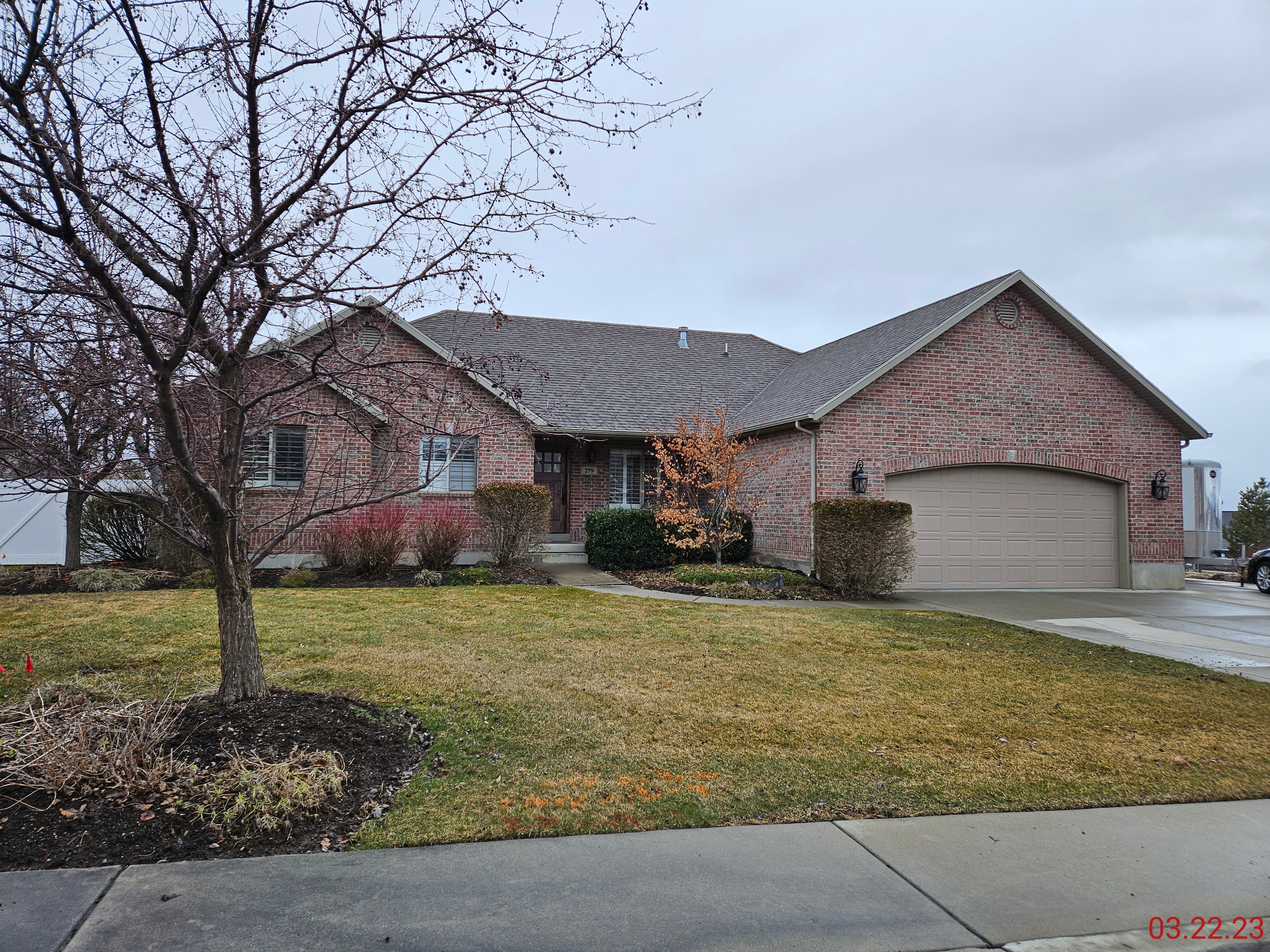
Property Address:  279 W 570 NORTH - LINDON  
Mailing Address: 279 W 570 N LINDON, UT 84042-1343  
Acreage: 0.498337  
Last Document: 4343-2023  
Subdivision Map Filing   
Taxing Description:  LOT 20, PLAT B, MANZANA ACRES SUB AREA 0.498 AC.

*Taxing description NOT FOR LEGAL DOCUMENTS


  • Owner Names
  • Value History
  • Tax History
  • Location
  • Photos
  • Documents
  • Aerial Image
  
2024...   ALVORD FAMILY TRUST 01-11-2021
2024...   ALVORD, AMY
2024...   ALVORD, KELLY
 
----- Real Estate Values -----
---Improvements---
---Greenbelt---
Total
Year
Com
Res
Agr
Tot
Com
Res
Agr
Tot
Land
Homesite
Tot
    Market Value
2024
$0
$425,800
$0
$425,800
$0
$570,400
$0
$570,400
$0
$0
$0
$996,200
Year
General Taxes
Adjustments
Net Taxes
Fees
Payments
Tax Balance*
Balance Due
Tax District
2025
$0.00
$0.00
$0.00
$0.00
$0.00
$0.00     080 - LINDON CITY
2024
$4,444.65
$0.00
$4,444.65
$0.00 Click for Payoff     080 - LINDON CITY

* Note: Original tax amount (Does not include applicable interest and/or fees).
Parcel Photo
Entry # Date Recorded Type Party1 (Grantor) Party2 (Grantee)
44947-2024 07/08/2024 07/08/2024 RSUBTEE CONSTRUCTION LOAN SERVICES II LLC (ET AL) SEGO VENTURES #6 LC
4343-2023 01/17/2023 01/24/2023 S PLAT ALVORD, KELLY & AMY TEE (ET AL) MANZANA ACRES PLAT B


Main Menu

Comments or Concerns on Value/Appraisal - Assessor's Office
Documents/Owner/Parcel information - Recorder's Office
Address Change for Tax Notice

This page was created on 10/12/2024 2:06:13 PM

× Large Image