Property Information
mobile view
| Serial Number: 07:103:0015 |
Serial Life: 1993-1998 |
|
|
Total Photos: 1
|
| |
|
|
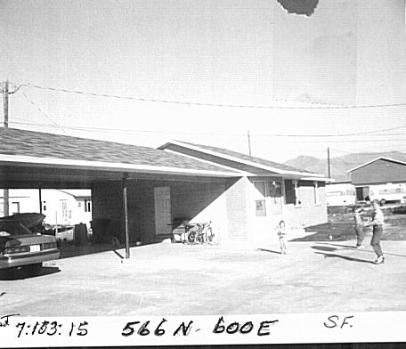
| Property Address: 564 N 600 EAST - SPANISH FORK |
|
| Mailing Address: PO BOX 422 SALEM, UT 84653-0422 |
|
| Acreage: 0.18 |
|
| Last Document:
8374-1979
|
|
| Subdivision Map Filing |
|
| Taxing Description:
COM SW LOT 3, BLK 103, PLAT A SPANISH FORK CITY SUR; N 90 FT; S 86 DEG 42'14" E 108.77 FT; N 67 DEG 00'06"W 97.85 FT; S 45.55 FT; W 198 FT TO BEG. AREA .18 ACRE.
*Taxing description NOT FOR LEGAL DOCUMENTS
|
|
- Owner Names
- Value History
- Tax History
- Location
- Photos
- Documents
- Aerial Image
| |
----- Real Estate Values ----- |
---Improvements--- |
---Greenbelt--- |
Total |
| Year |
Com |
Res |
Agr |
Tot |
Com |
Res |
Agr |
Tot |
Land |
Homesite |
Tot |
Market Value |
| 1998 |
$0 |
$21,552 |
$0 |
$21,552 |
$0 |
$135,087 |
$0 |
$135,087 |
$0 |
$0 |
$0 |
$156,639 |
| 1997 |
$0 |
$21,552 |
$0 |
$21,552 |
$0 |
$135,087 |
$0 |
$135,087 |
$0 |
$0 |
$0 |
$156,639 |
| 1996 |
$0 |
$20,900 |
$0 |
$20,900 |
$0 |
$131,000 |
$0 |
$131,000 |
$0 |
$0 |
$0 |
$151,900 |
| 1995 |
$0 |
$19,000 |
$0 |
$19,000 |
$0 |
$131,000 |
$0 |
$131,000 |
$0 |
$0 |
$0 |
$150,000 |
| 1994 |
$0 |
$17,440 |
$0 |
$17,440 |
$0 |
$85,000 |
$0 |
$85,000 |
$0 |
$0 |
$0 |
$102,440 |
| 1993 |
$0 |
$17,440 |
$0 |
$17,440 |
$0 |
$0 |
$0 |
$0 |
$0 |
$0 |
$0 |
$17,440 |
| Year |
General Taxes |
Adjustments |
Net Taxes |
Fees |
Payments |
Tax Balance* |
Balance Due |
Tax District |
| 1998 |
$879.10 |
$0.00 |
$879.10 |
$0.00 |
|
$0.00
|
$0.00 |
150 - SPANISH FORK CITY |
| 1997 |
$989.37 |
$0.00 |
$989.37 |
$0.00 |
|
$0.00
|
$0.00 |
150 - SPANISH FORK CITY |
| 1996 |
$944.48 |
$0.00 |
$944.48 |
$0.00 |
|
$0.00
|
$0.00 |
150 - SPANISH FORK CITY |
| 1995 |
$921.77 |
$0.00 |
$921.77 |
$0.00 |
|
$0.00
|
$0.00 |
150 - SPANISH FORK CITY |
| 1994 |
$965.75 |
$0.00 |
$965.75 |
$0.00 |
|
$0.00
|
$0.00 |
150 - SPANISH FORK CITY |
| 1993 |
$210.20 |
$0.00 |
$210.20 |
$0.00 |
|
$0.00
|
$0.00 |
150 - SPANISH FORK CITY |
* Note: Original tax amount (Does not include applicable interest and/or fees).
| Entry # |
Date |
Recorded |
Type |
Party1 (Grantor) |
Party2 (Grantee) |
| 68640-1998 |
04/15/1998 |
07/09/1998 |
SP WD |
TERVORT, PAUL & MARY JO (ET AL) |
TERVORT, PAUL & MARY JO TEE |
| 83154-1996 |
08/19/1996 |
10/09/1996 |
AS |
PRUDENTIAL HOME MORTGAGE COMPANY INC THE |
NORWEST MORTGAGE INC |
| 74712-1994 |
08/03/1994 |
09/22/1994 |
AS |
FAR WEST BANK |
PRUDENTIAL HOME MORTGAGE COMPANY INC THE |
| 63100-1994 |
08/03/1994 |
08/08/1994 |
AS |
FAR WEST BANK |
PRUDENTIAL HOME MORTGAGE COMPANY INC THE |
| 16893-1994 |
02/23/1994 |
03/01/1994 |
REC |
CENTRAL BANK & TRUST COMPANY TEE |
SALISBURY, RICK M & VICTORIA |
| 12036-1994 |
02/09/1994 |
02/10/1994 |
D TR |
TERVORT, PAUL & MARY JO (ET AL) |
FAR WEST BANK |
| 12035-1994 |
02/09/1994 |
02/10/1994 |
WD |
SALISBURY, RICK |
TERVORT, PAUL & MARY JO |
| 75146-1993 |
10/22/1993 |
10/22/1993 |
D TR |
SALISBURY, RICK M & VICTORIA |
CENTRAL BANK |
| 71101-1993 |
10/07/1993 |
10/08/1993 |
WD |
NELSON, ROBERT C & LINDA KAREN |
SALISBURY, RICK |
| 21884-1992 |
05/04/1992 |
05/05/1992 |
WD |
NELSON, ROBERT C & LINDA KAREN |
GEE, LAEL B |
Main Menu Comments or Concerns on Value/Appraisal - Assessor's Office
Documents/Owner/Parcel information - Recorder's Office
Address Change for Tax Notice
This page was created on 7/10/2024 6:32:42 AM |