Property Information
mobile view
| Serial Number: 08:035:0002 |
Serial Life: 1977-2023 |
|
|
 Total Photos: 2
|
| |
|
|
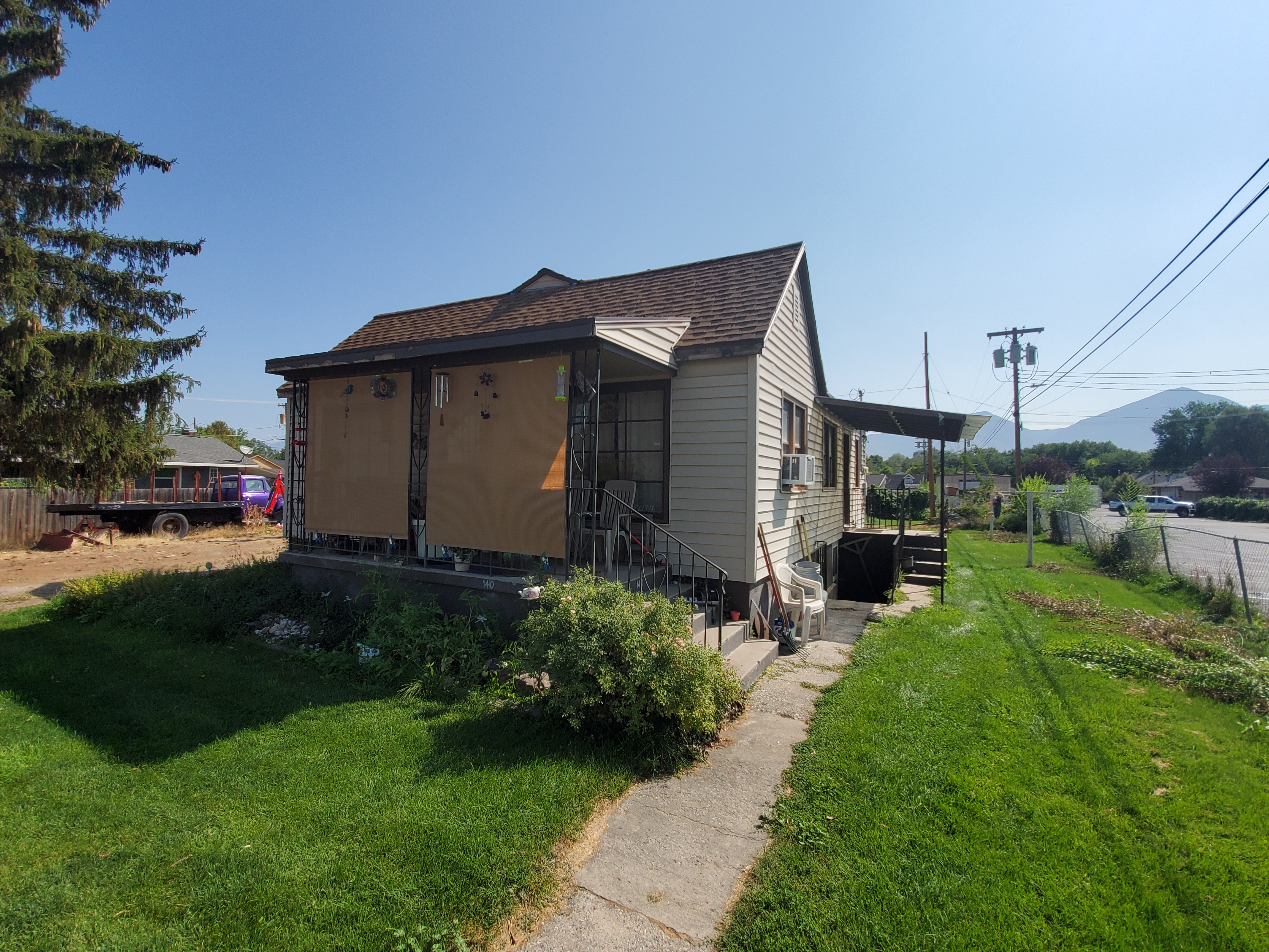
| Property Address: 140 N 300 EAST - PAYSON |
|
| Mailing Address: 140 N 300 E PAYSON, UT 84651-1821 |
|
| Acreage: 0.34 |
|
| Last Document:
2065-1972
|
|
| Subdivision Map Filing |
|
| Taxing Description:
COM. 3.44 CHS N OF SW COR OF BLK 42, PLAT A, PAYSON CITY SURVEY; E 3.75 CHS; S 60 FT; W 3.75 CHS; N 60 FT TO BEG.
*Taxing description NOT FOR LEGAL DOCUMENTS
|
|
- Owner Names
- Value History
- Tax History
- Location
- Photos
- Documents
- Aerial Image
| |
----- Real Estate Values ----- |
---Improvements--- |
---Greenbelt--- |
Total |
| Year |
Com |
Res |
Agr |
Tot |
Com |
Res |
Agr |
Tot |
Land |
Homesite |
Tot |
Market Value |
| 2023 |
$0 |
$119,100 |
$0 |
$119,100 |
$0 |
$214,800 |
$0 |
$214,800 |
$0 |
$0 |
$0 |
$333,900 |
| 2022 |
$0 |
$127,000 |
$0 |
$127,000 |
$0 |
$179,500 |
$0 |
$179,500 |
$0 |
$0 |
$0 |
$306,500 |
| 2021 |
$0 |
$90,700 |
$0 |
$90,700 |
$0 |
$138,100 |
$0 |
$138,100 |
$0 |
$0 |
$0 |
$228,800 |
| 2020 |
$0 |
$78,900 |
$0 |
$78,900 |
$0 |
$128,100 |
$0 |
$128,100 |
$0 |
$0 |
$0 |
$207,000 |
| 2019 |
$0 |
$71,000 |
$0 |
$71,000 |
$0 |
$126,200 |
$0 |
$126,200 |
$0 |
$0 |
$0 |
$197,200 |
| 2018 |
$0 |
$59,900 |
$0 |
$59,900 |
$0 |
$109,700 |
$0 |
$109,700 |
$0 |
$0 |
$0 |
$169,600 |
| 2017 |
$0 |
$56,800 |
$0 |
$56,800 |
$0 |
$95,400 |
$0 |
$95,400 |
$0 |
$0 |
$0 |
$152,200 |
| 2016 |
$0 |
$51,300 |
$0 |
$51,300 |
$0 |
$87,100 |
$0 |
$87,100 |
$0 |
$0 |
$0 |
$138,400 |
| 2015 |
$0 |
$47,300 |
$0 |
$47,300 |
$0 |
$80,600 |
$0 |
$80,600 |
$0 |
$0 |
$0 |
$127,900 |
| 2014 |
$0 |
$43,400 |
$0 |
$43,400 |
$0 |
$73,500 |
$0 |
$73,500 |
$0 |
$0 |
$0 |
$116,900 |
| 2013 |
$0 |
$37,900 |
$0 |
$37,900 |
$0 |
$63,900 |
$0 |
$63,900 |
$0 |
$0 |
$0 |
$101,800 |
| 2012 |
$0 |
$39,500 |
$0 |
$39,500 |
$0 |
$71,700 |
$0 |
$71,700 |
$0 |
$0 |
$0 |
$111,200 |
| 2011 |
$0 |
$38,800 |
$0 |
$38,800 |
$0 |
$78,700 |
$0 |
$78,700 |
$0 |
$0 |
$0 |
$117,500 |
| 2010 |
$0 |
$42,646 |
$0 |
$42,646 |
$0 |
$82,228 |
$0 |
$82,228 |
$0 |
$0 |
$0 |
$124,874 |
| 2009 |
$0 |
$57,200 |
$0 |
$57,200 |
$0 |
$73,600 |
$0 |
$73,600 |
$0 |
$0 |
$0 |
$130,800 |
| 2008 |
$0 |
$57,200 |
$0 |
$57,200 |
$0 |
$80,500 |
$0 |
$80,500 |
$0 |
$0 |
$0 |
$137,700 |
| 2007 |
$0 |
$59,000 |
$0 |
$59,000 |
$0 |
$83,000 |
$0 |
$83,000 |
$0 |
$0 |
$0 |
$142,000 |
| 2006 |
$0 |
$37,200 |
$0 |
$37,200 |
$0 |
$83,500 |
$0 |
$83,500 |
$0 |
$0 |
$0 |
$120,700 |
| 2005 |
$0 |
$35,440 |
$0 |
$35,440 |
$0 |
$79,490 |
$0 |
$79,490 |
$0 |
$0 |
$0 |
$114,930 |
| 2004 |
$0 |
$35,440 |
$0 |
$35,440 |
$0 |
$79,490 |
$0 |
$79,490 |
$0 |
$0 |
$0 |
$114,930 |
| 2003 |
$0 |
$35,440 |
$0 |
$35,440 |
$0 |
$79,490 |
$0 |
$79,490 |
$0 |
$0 |
$0 |
$114,930 |
| 2002 |
$0 |
$35,440 |
$0 |
$35,440 |
$0 |
$79,490 |
$0 |
$79,490 |
$0 |
$0 |
$0 |
$114,930 |
| 2001 |
$0 |
$40,736 |
$0 |
$40,736 |
$0 |
$72,264 |
$0 |
$72,264 |
$0 |
$0 |
$0 |
$113,000 |
| 2000 |
$0 |
$38,071 |
$0 |
$38,071 |
$0 |
$62,882 |
$0 |
$62,882 |
$0 |
$0 |
$0 |
$100,953 |
| 1999 |
$0 |
$38,071 |
$0 |
$38,071 |
$0 |
$62,882 |
$0 |
$62,882 |
$0 |
$0 |
$0 |
$100,953 |
| 1998 |
$0 |
$38,071 |
$0 |
$38,071 |
$0 |
$62,882 |
$0 |
$62,882 |
$0 |
$0 |
$0 |
$100,953 |
| 1997 |
$0 |
$38,071 |
$0 |
$38,071 |
$0 |
$62,882 |
$0 |
$62,882 |
$0 |
$0 |
$0 |
$100,953 |
| 1996 |
$0 |
$30,562 |
$0 |
$30,562 |
$0 |
$50,479 |
$0 |
$50,479 |
$0 |
$0 |
$0 |
$81,041 |
| 1995 |
$0 |
$27,784 |
$0 |
$27,784 |
$0 |
$50,479 |
$0 |
$50,479 |
$0 |
$0 |
$0 |
$78,263 |
| 1994 |
$0 |
$16,248 |
$0 |
$16,248 |
$0 |
$40,709 |
$0 |
$40,709 |
$0 |
$0 |
$0 |
$56,957 |
| 1993 |
$0 |
$16,248 |
$0 |
$16,248 |
$0 |
$40,709 |
$0 |
$40,709 |
$0 |
$0 |
$0 |
$56,957 |
| 1992 |
$0 |
$14,906 |
$0 |
$14,906 |
$0 |
$37,348 |
$0 |
$37,348 |
$0 |
$0 |
$0 |
$52,254 |
| 1991 |
$0 |
$13,075 |
$0 |
$13,075 |
$0 |
$32,761 |
$0 |
$32,761 |
$0 |
$0 |
$0 |
$45,836 |
| 1990 |
$0 |
$13,075 |
$0 |
$13,075 |
$0 |
$32,761 |
$0 |
$32,761 |
$0 |
$0 |
$0 |
$45,836 |
| 1989 |
$0 |
$13,075 |
$0 |
$13,075 |
$0 |
$32,761 |
$0 |
$32,761 |
$0 |
$0 |
$0 |
$45,836 |
| 1988 |
$0 |
$13,075 |
$0 |
$13,075 |
$0 |
$32,762 |
$0 |
$32,762 |
$0 |
$0 |
$0 |
$45,837 |
| 1987 |
$0 |
$13,075 |
$0 |
$13,075 |
$0 |
$25,017 |
$0 |
$25,017 |
$0 |
$0 |
$0 |
$38,092 |
| 1986 |
$0 |
$13,075 |
$0 |
$13,075 |
$0 |
$25,017 |
$0 |
$25,017 |
$0 |
$0 |
$0 |
$38,092 |
| 1985 |
$0 |
$13,075 |
$0 |
$13,075 |
$0 |
$25,017 |
$0 |
$25,017 |
$0 |
$0 |
$0 |
$38,092 |
| 1984 |
$0 |
$13,208 |
$0 |
$13,208 |
$0 |
$25,267 |
$0 |
$25,267 |
$0 |
$0 |
$0 |
$38,475 |
| Year |
General Taxes |
Adjustments |
Net Taxes |
Fees |
Payments |
Tax Balance* |
Balance Due |
Tax District |
| 2023 |
$1,799.54 |
($1,799.54) |
$0.00 |
$0.00 |
|
$0.00
|
$0.00 |
170 - PAYSON CITY |
| 2022 |
$1,679.51 |
($1,679.51) |
$0.00 |
$0.00 |
|
$0.00
|
$0.00 |
170 - PAYSON CITY |
| 2021 |
$1,421.24 |
($1,421.24) |
$0.00 |
$0.00 |
|
$0.00
|
$0.00 |
170 - PAYSON CITY |
| 2020 |
$1,314.28 |
($1,314.28) |
$0.00 |
$0.00 |
|
$0.00
|
$0.00 |
170 - PAYSON CITY |
| 2019 |
$1,221.26 |
($1,221.26) |
$0.00 |
$0.00 |
|
$0.00
|
$0.00 |
170 - PAYSON CITY |
| 2018 |
$1,089.79 |
($1,089.79) |
$0.00 |
$0.00 |
|
$0.00
|
$0.00 |
170 - PAYSON CITY |
| 2017 |
$1,000.08 |
($1,000.08) |
$0.00 |
$0.00 |
|
$0.00
|
$0.00 |
170 - PAYSON CITY |
| 2016 |
$915.42 |
$0.00 |
$915.42 |
$0.00 |
|
$0.00
|
$0.00 |
170 - PAYSON CITY |
| 2015 |
$851.81 |
$0.00 |
$851.81 |
$0.00 |
|
$0.00
|
$0.00 |
170 - PAYSON CITY |
| 2014 |
$772.95 |
$0.00 |
$772.95 |
$0.00 |
|
$0.00
|
$0.00 |
170 - PAYSON CITY |
| 2013 |
$704.58 |
$0.00 |
$704.58 |
$0.00 |
|
$0.00
|
$0.00 |
170 - PAYSON CITY |
| 2012 |
$781.26 |
$0.00 |
$781.26 |
$0.00 |
|
$0.00
|
$0.00 |
170 - PAYSON CITY |
| 2011 |
$805.94 |
$0.00 |
$805.94 |
$0.00 |
|
$0.00
|
$0.00 |
170 - PAYSON CITY |
| 2010 |
$835.15 |
$0.00 |
$835.15 |
$0.00 |
|
$0.00
|
$0.00 |
170 - PAYSON CITY |
| 2009 |
$828.53 |
$0.00 |
$828.53 |
$0.00 |
|
$0.00
|
$0.00 |
170 - PAYSON CITY |
| 2008 |
$811.35 |
$0.00 |
$811.35 |
$0.00 |
|
$0.00
|
$0.00 |
170 - PAYSON CITY |
| 2007 |
$829.89 |
$0.00 |
$829.89 |
$0.00 |
|
$0.00
|
$0.00 |
170 - PAYSON CITY |
| 2006 |
$783.81 |
$0.00 |
$783.81 |
$0.00 |
|
$0.00
|
$0.00 |
170 - PAYSON CITY |
| 2005 |
$794.51 |
($397.25) |
$397.26 |
$0.00 |
|
$0.00
|
$0.00 |
170 - PAYSON CITY |
| 2004 |
$796.72 |
$0.00 |
$796.72 |
$0.00 |
|
$0.00
|
$0.00 |
170 - PAYSON CITY |
| 2003 |
$723.15 |
$0.00 |
$723.15 |
$0.00 |
|
$0.00
|
$0.00 |
170 - PAYSON CITY |
| 2002 |
$705.83 |
$0.00 |
$705.83 |
$0.00 |
|
$0.00
|
$0.00 |
170 - PAYSON CITY |
| 2001 |
$706.83 |
$0.00 |
$706.83 |
$0.00 |
|
$0.00
|
$0.00 |
170 - PAYSON CITY |
| 2000 |
$624.70 |
$0.00 |
$624.70 |
$0.00 |
|
$0.00
|
$0.00 |
170 - PAYSON CITY |
| 1999 |
$593.05 |
$0.00 |
$593.05 |
$0.00 |
|
$0.00
|
$0.00 |
170 - PAYSON CITY |
| 1998 |
$578.39 |
$0.00 |
$578.39 |
$0.00 |
|
$0.00
|
$0.00 |
170 - PAYSON CITY |
| 1997 |
$637.97 |
$0.00 |
$637.97 |
$0.00 |
|
$0.00
|
$0.00 |
170 - PAYSON CITY |
| 1996 |
$504.51 |
$0.00 |
$504.51 |
$0.00 |
|
$0.00
|
$0.00 |
170 - PAYSON CITY |
| 1995 |
$486.96 |
$0.00 |
$486.96 |
$0.00 |
|
$0.00
|
$0.00 |
170 - PAYSON CITY |
| 1994 |
$545.02 |
$0.00 |
$545.02 |
$0.00 |
|
$0.00
|
$0.00 |
170 - PAYSON CITY |
| 1993 |
$495.00 |
$0.00 |
$495.00 |
$0.00 |
|
$0.00
|
$0.00 |
170 - PAYSON CITY |
| 1992 |
$443.45 |
$0.00 |
$443.45 |
$0.00 |
|
$0.00
|
$0.00 |
170 - PAYSON CITY |
| 1991 |
$409.48 |
$0.00 |
$409.48 |
$0.00 |
|
$0.00
|
$0.00 |
170 - PAYSON CITY |
| 1990 |
$409.97 |
$0.00 |
$409.97 |
$0.00 |
|
$0.00
|
$0.00 |
170 - PAYSON CITY |
| 1989 |
$412.12 |
$0.00 |
$412.12 |
$0.00 |
|
$0.00
|
$0.00 |
170 - PAYSON CITY |
| 1988 |
$412.12 |
$0.00 |
$412.12 |
$0.00 |
|
$0.00
|
$0.00 |
170 - PAYSON CITY |
| 1987 |
$343.46 |
$0.00 |
$343.46 |
$0.00 |
|
$0.00
|
$0.00 |
170 - PAYSON CITY |
| 1986 |
$325.25 |
$0.00 |
$325.25 |
$0.00 |
|
$0.00
|
$0.00 |
170 - PAYSON CITY |
| 1985 |
$316.63 |
$0.00 |
$316.63 |
$0.00 |
|
$0.00
|
$0.00 |
170 - PAYSON CITY |
| 1984 |
$299.18 |
$0.00 |
$299.18 |
$0.00 |
|
$0.00
|
$0.00 |
170 - PAYSON CITY |
* Note: Original tax amount (Does not include applicable interest and/or fees).
| Entry # |
Date |
Recorded |
Type |
Party1 (Grantor) |
Party2 (Grantee) |
| 72586-2023 |
11/03/2023 |
11/03/2023 |
QCD |
GILSON, TERRY V & LINDA R |
GILSON, TERRY V & LINDA R |
| 102576-2021 |
|
06/03/2021 |
AS FNST |
CROSS RIVER BANK |
SLSLT UNDERLYING TRUST 2020-1 |
| 59191-2021 |
|
03/30/2021 |
FN ST |
GILSON, TERRY |
CROSS RIVER BANK |
| 3187-2015 |
12/04/2014 |
01/14/2015 |
QCD |
UNITED STATES OF AMERICA |
SOUTH UTAH VALLEY ELECTRIC SERVICE DISTRICT |
| 88801-2009 |
07/30/2009 |
08/13/2009 |
REC |
RICHARDS, BRUCE L TEE |
GILSON, TERRY V & LINDA R |
| 88800-2009 |
06/26/2009 |
08/13/2009 |
SUB TEE |
FAMILY FIRST FEDERAL CREDIT UNION |
RICHARDS, BRUCE L SUCTEE |
| 114949-2008 |
10/20/2008 |
10/22/2008 |
CT |
STATE OF UTAH |
WHOM OF INTEREST |
| 107508-2008 |
09/30/2008 |
09/30/2008 |
RESOL |
BOARD OF COUNTY COMMISSIONERS UTAH COUNTY |
WHOM OF INTEREST |
| 7855-2004 |
01/19/2004 |
01/23/2004 |
REC |
RICHARDS, BRUCE L TEE |
GILSON, TERRY V & LINDA R |
| 7854-2004 |
10/13/2003 |
01/23/2004 |
SUB TEE |
FAMILY FIRST FEDERAL CREDIT UNION |
RICHARDS, BRUCE L SUCTEE |
| 161866-2003 |
10/03/2003 |
10/06/2003 |
D TR |
GILSON, TERRY V & LINDA R |
FAMILY FIRST FEDERAL CREDIT UNION |
| 1358-2001 |
01/05/2001 |
01/05/2001 |
REC |
PROVO ABSTRACT COMPANY TEE |
GILSON, TERRY V & LINDA R |
| 75422-2000 |
09/19/2000 |
09/25/2000 |
D TR |
GILSON, TERRY V & LINDA R |
FAMILY FIRST FEDERAL CREDIT UNION |
| 42685-1993 |
06/23/1993 |
06/29/1993 |
D TR |
GILSON, TERRY V & LINDA R |
FAMILY FIRST FEDERAL CREDIT UNION |
| 29165-1988 |
09/23/1988 |
09/27/1988 |
REC |
CENTRAL BANK & TRUST COMPANY TEE |
GILSON, TERRY V & LINDA R |
| 36587-1986 |
05/22/1986 |
10/27/1986 |
AS |
GILL RICHARD COMPANY THE |
BANCPLUS MORTGAGE CORP |
| 9336-1985 |
03/11/1985 |
04/08/1985 |
AS |
BETTILYON MORTGAGE LOAN COMPANY |
GILL RICHARD COMPANY THE |
| 16108-1982 |
06/24/1982 |
06/29/1982 |
RC |
CENTRAL BANK & TRUST COMPANY |
WHOM OF INTEREST |
| 16107-1982 |
06/24/1982 |
06/29/1982 |
TR D |
GILSON, TERRY V & LINDA R |
CENTRAL BANK & TRUST COMPANY |
| 14960-1982 |
06/15/1982 |
06/16/1982 |
REC |
SECURITY TITLE AND ABSTRACT COMPANY TEE |
GILSON, TERRY V & LINDA R |
Main Menu Comments or Concerns on Value/Appraisal - Assessor's Office
Documents/Owner/Parcel information - Recorder's Office
Address Change for Tax Notice
This page was created on 4/6/2025 12:25:44 PM |
