Property Information
mobile view
| Serial Number: 08:039:0007 |
Serial Life: 1978... |
|
|
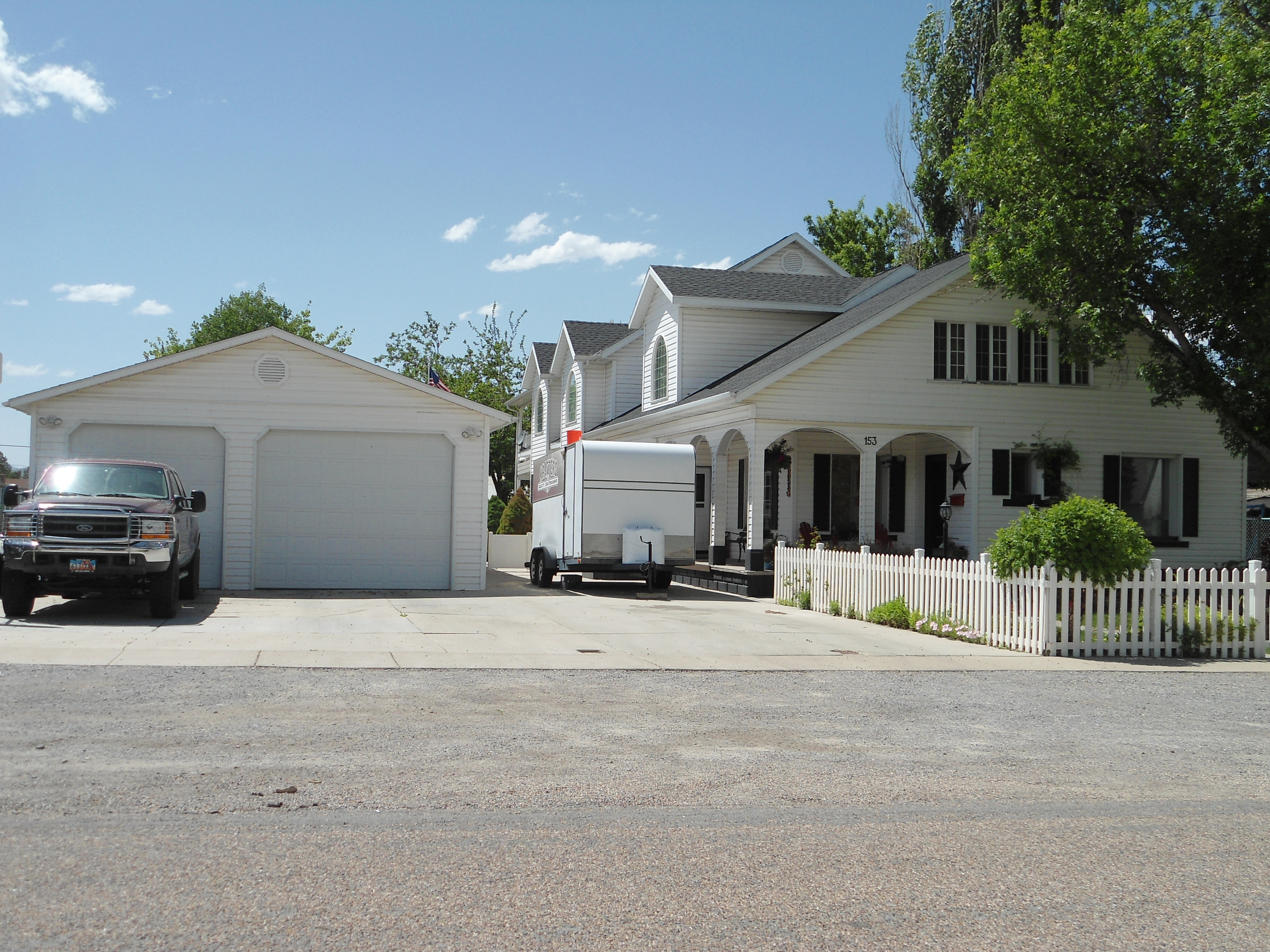 Total Photos: 2
|
| |
|
|
| Property Address: 153 N 100 WEST - PAYSON |
|
| Mailing Address: 153 N 100 W PAYSON, UT 84651-1414 |
|
| Acreage: 0.36 |
|
| Last Document:
26086-2009
|
|
| Subdivision Map Filing |
|
| Taxing Description:
COM. AT NE COR OF LOT 2, BLK 47, PLAT A, PAYSON CITY SURVEY; W 184.37 FT; S 30 FT; E 184.37 FT; N 30 FT TO BEG. ALSO COM. AT SE COR OF LOT 3, BLK 47 PLAT A, PAYSON CITY SURVEY; N 56 FT; W 184.375 FT; S 56 FT; E 184.375 FT TO BEG.
*Taxing description NOT FOR LEGAL DOCUMENTS
|
|
- Owner Names
- Value History
- Tax History
- Location
- Photos
- Documents
- Aerial Image
| 2021... |
|
BURDICK, BRAD M |
|
| 2021... |
|
BURDICK, BRENDA LYNN |
|
| 2010-2020 |
|
BURDICK, BRAD M |
|
| 2010-2020 |
|
BURDICK, BRENDA C |
|
| 2005-2009 |
|
BURDICK, BRENDA C |
|
| 1992-2004 |
|
BURDICK, BRAD M |
|
| 1992-2004 |
|
BURDICK, BRENDA C |
|
| 1991 |
|
BURDICK, BRAD M |
|
| 1991 |
|
BURDICK, BRENDA C |
|
| 1988-1990 |
|
BURDICK, BRAD M |
|
| 1988-1990 |
|
BURDICK, BRENDA C |
|
| 1983-1987 |
|
BURDICK, BRAD M |
|
| 1983-1987 |
|
BURDICK, BRENDA C |
|
| 1978-1982 |
|
BURDICK, BRAD M |
|
| 1978-1982 |
|
BURDICK, BRENDA C |
|
| |
----- Real Estate Values ----- |
---Improvements--- |
---Greenbelt--- |
Total |
| Year |
Com |
Res |
Agr |
Tot |
Com |
Res |
Agr |
Tot |
Land |
Homesite |
Tot |
Market Value |
| 2024 |
$0 |
$120,700 |
$0 |
$120,700 |
$0 |
$511,800 |
$0 |
$511,800 |
$0 |
$0 |
$0 |
$632,500 |
| 2023 |
$0 |
$120,700 |
$0 |
$120,700 |
$0 |
$526,900 |
$0 |
$526,900 |
$0 |
$0 |
$0 |
$647,600 |
| 2022 |
$0 |
$128,700 |
$0 |
$128,700 |
$0 |
$467,700 |
$0 |
$467,700 |
$0 |
$0 |
$0 |
$596,400 |
| 2021 |
$0 |
$91,900 |
$0 |
$91,900 |
$0 |
$359,800 |
$0 |
$359,800 |
$0 |
$0 |
$0 |
$451,700 |
| 2020 |
$0 |
$79,900 |
$0 |
$79,900 |
$0 |
$333,800 |
$0 |
$333,800 |
$0 |
$0 |
$0 |
$413,700 |
| 2019 |
$0 |
$71,900 |
$0 |
$71,900 |
$0 |
$290,300 |
$0 |
$290,300 |
$0 |
$0 |
$0 |
$362,200 |
| 2018 |
$0 |
$60,700 |
$0 |
$60,700 |
$0 |
$252,400 |
$0 |
$252,400 |
$0 |
$0 |
$0 |
$313,100 |
| 2017 |
$0 |
$57,500 |
$0 |
$57,500 |
$0 |
$219,500 |
$0 |
$219,500 |
$0 |
$0 |
$0 |
$277,000 |
| 2016 |
$0 |
$51,900 |
$0 |
$51,900 |
$0 |
$219,500 |
$0 |
$219,500 |
$0 |
$0 |
$0 |
$271,400 |
| 2015 |
$0 |
$47,900 |
$0 |
$47,900 |
$0 |
$190,900 |
$0 |
$190,900 |
$0 |
$0 |
$0 |
$238,800 |
| 2014 |
$0 |
$43,900 |
$0 |
$43,900 |
$0 |
$190,900 |
$0 |
$190,900 |
$0 |
$0 |
$0 |
$234,800 |
| 2013 |
$0 |
$38,500 |
$0 |
$38,500 |
$0 |
$190,900 |
$0 |
$190,900 |
$0 |
$0 |
$0 |
$229,400 |
| 2012 |
$0 |
$40,000 |
$0 |
$40,000 |
$0 |
$216,900 |
$0 |
$216,900 |
$0 |
$0 |
$0 |
$256,900 |
| 2011 |
$0 |
$39,600 |
$0 |
$39,600 |
$0 |
$228,000 |
$0 |
$228,000 |
$0 |
$0 |
$0 |
$267,600 |
| 2010 |
$0 |
$43,537 |
$0 |
$43,537 |
$0 |
$240,967 |
$0 |
$240,967 |
$0 |
$0 |
$0 |
$284,504 |
| 2009 |
$0 |
$51,800 |
$0 |
$51,800 |
$0 |
$251,500 |
$0 |
$251,500 |
$0 |
$0 |
$0 |
$303,300 |
| 2008 |
$0 |
$51,800 |
$0 |
$51,800 |
$0 |
$280,800 |
$0 |
$280,800 |
$0 |
$0 |
$0 |
$332,600 |
| 2007 |
$0 |
$53,400 |
$0 |
$53,400 |
$0 |
$289,500 |
$0 |
$289,500 |
$0 |
$0 |
$0 |
$342,900 |
| 2006 |
$0 |
$46,400 |
$0 |
$46,400 |
$0 |
$263,200 |
$0 |
$263,200 |
$0 |
$0 |
$0 |
$309,600 |
| 2005 |
$0 |
$44,176 |
$0 |
$44,176 |
$0 |
$250,707 |
$0 |
$250,707 |
$0 |
$0 |
$0 |
$294,883 |
| 2004 |
$0 |
$44,176 |
$0 |
$44,176 |
$0 |
$250,707 |
$0 |
$250,707 |
$0 |
$0 |
$0 |
$294,883 |
| 2003 |
$0 |
$44,176 |
$0 |
$44,176 |
$0 |
$205,824 |
$0 |
$205,824 |
$0 |
$0 |
$0 |
$250,000 |
| 2002 |
$0 |
$44,176 |
$0 |
$44,176 |
$0 |
$205,824 |
$0 |
$205,824 |
$0 |
$0 |
$0 |
$250,000 |
| 2001 |
$0 |
$44,176 |
$0 |
$44,176 |
$0 |
$205,824 |
$0 |
$205,824 |
$0 |
$0 |
$0 |
$250,000 |
| 2000 |
$0 |
$41,286 |
$0 |
$41,286 |
$0 |
$59,177 |
$0 |
$59,177 |
$0 |
$0 |
$0 |
$100,463 |
| 1999 |
$0 |
$41,286 |
$0 |
$41,286 |
$0 |
$59,177 |
$0 |
$59,177 |
$0 |
$0 |
$0 |
$100,463 |
| 1998 |
$0 |
$41,286 |
$0 |
$41,286 |
$0 |
$59,177 |
$0 |
$59,177 |
$0 |
$0 |
$0 |
$100,463 |
| 1997 |
$0 |
$41,286 |
$0 |
$41,286 |
$0 |
$59,177 |
$0 |
$59,177 |
$0 |
$0 |
$0 |
$100,463 |
| 1996 |
$0 |
$31,007 |
$0 |
$31,007 |
$0 |
$44,444 |
$0 |
$44,444 |
$0 |
$0 |
$0 |
$75,451 |
| 1995 |
$0 |
$28,188 |
$0 |
$28,188 |
$0 |
$44,444 |
$0 |
$44,444 |
$0 |
$0 |
$0 |
$72,632 |
| 1994 |
$0 |
$16,484 |
$0 |
$16,484 |
$0 |
$35,842 |
$0 |
$35,842 |
$0 |
$0 |
$0 |
$52,326 |
| 1993 |
$0 |
$16,484 |
$0 |
$16,484 |
$0 |
$35,842 |
$0 |
$35,842 |
$0 |
$0 |
$0 |
$52,326 |
| 1992 |
$0 |
$15,123 |
$0 |
$15,123 |
$0 |
$32,883 |
$0 |
$32,883 |
$0 |
$0 |
$0 |
$48,006 |
| 1991 |
$0 |
$13,266 |
$0 |
$13,266 |
$0 |
$28,845 |
$0 |
$28,845 |
$0 |
$0 |
$0 |
$42,111 |
| 1990 |
$0 |
$13,266 |
$0 |
$13,266 |
$0 |
$28,845 |
$0 |
$28,845 |
$0 |
$0 |
$0 |
$42,111 |
| 1989 |
$0 |
$13,266 |
$0 |
$13,266 |
$0 |
$28,845 |
$0 |
$28,845 |
$0 |
$0 |
$0 |
$42,111 |
| 1988 |
$0 |
$13,267 |
$0 |
$13,267 |
$0 |
$28,845 |
$0 |
$28,845 |
$0 |
$0 |
$0 |
$42,112 |
| 1987 |
$0 |
$13,267 |
$0 |
$13,267 |
$0 |
$24,392 |
$0 |
$24,392 |
$0 |
$0 |
$0 |
$37,659 |
| 1986 |
$0 |
$13,267 |
$0 |
$13,267 |
$0 |
$24,392 |
$0 |
$24,392 |
$0 |
$0 |
$0 |
$37,659 |
| 1985 |
$0 |
$13,267 |
$0 |
$13,267 |
$0 |
$24,392 |
$0 |
$24,392 |
$0 |
$0 |
$0 |
$37,659 |
| 1984 |
$0 |
$13,400 |
$0 |
$13,400 |
$0 |
$24,642 |
$0 |
$24,642 |
$0 |
$0 |
$0 |
$38,042 |
| Year |
General Taxes |
Adjustments |
Net Taxes |
Fees |
Payments |
Tax Balance* |
Balance Due |
Tax District |
| 2025 |
$0.00 |
$0.00 |
$0.00 |
$0.00 |
|
$0.00
|
$0.00 |
170 - PAYSON CITY |
| 2024 |
$3,418.22 |
$0.00 |
$3,418.22 |
$0.00 |
|
$0.00
|
$0.00 |
170 - PAYSON CITY |
| 2023 |
$3,490.21 |
$0.00 |
$3,490.21 |
$0.00 |
|
$0.00
|
$0.00 |
170 - PAYSON CITY |
| 2022 |
$3,268.06 |
$0.00 |
$3,268.06 |
$0.00 |
|
$0.00
|
$0.00 |
170 - PAYSON CITY |
| 2021 |
$2,805.82 |
$0.00 |
$2,805.82 |
$0.00 |
|
$0.00
|
$0.00 |
170 - PAYSON CITY |
| 2020 |
$2,626.66 |
$0.00 |
$2,626.66 |
$0.00 |
|
$0.00
|
$0.00 |
170 - PAYSON CITY |
| 2019 |
$2,243.10 |
$0.00 |
$2,243.10 |
$0.00 |
|
$0.00
|
$0.00 |
170 - PAYSON CITY |
| 2018 |
$2,011.87 |
$0.00 |
$2,011.87 |
$0.00 |
|
$0.00
|
$0.00 |
170 - PAYSON CITY |
| 2017 |
$1,820.13 |
$0.00 |
$1,820.13 |
$0.00 |
|
$0.00
|
$0.00 |
170 - PAYSON CITY |
| 2016 |
$1,795.12 |
$0.00 |
$1,795.12 |
$0.00 |
|
$0.00
|
$0.00 |
170 - PAYSON CITY |
| 2015 |
$1,590.40 |
$0.00 |
$1,590.40 |
$0.00 |
|
$0.00
|
$0.00 |
170 - PAYSON CITY |
| 2014 |
$1,552.52 |
$0.00 |
$1,552.52 |
$0.00 |
|
$0.00
|
$0.00 |
170 - PAYSON CITY |
| 2013 |
$1,587.72 |
$0.00 |
$1,587.72 |
$0.00 |
|
$0.00
|
$0.00 |
170 - PAYSON CITY |
| 2012 |
$1,804.90 |
$0.00 |
$1,804.90 |
$0.00 |
|
$0.00
|
$0.00 |
170 - PAYSON CITY |
| 2011 |
$1,835.48 |
$0.00 |
$1,835.48 |
$0.00 |
|
$0.00
|
$0.00 |
170 - PAYSON CITY |
| 2010 |
$1,902.76 |
$0.00 |
$1,902.76 |
$0.00 |
|
$0.00
|
$0.00 |
170 - PAYSON CITY |
| 2009 |
$1,921.21 |
$0.00 |
$1,921.21 |
$0.00 |
|
$0.00
|
$0.00 |
170 - PAYSON CITY |
| 2008 |
$1,959.73 |
$0.00 |
$1,959.73 |
$0.00 |
|
$0.00
|
$0.00 |
170 - PAYSON CITY |
| 2007 |
$2,004.01 |
$0.00 |
$2,004.01 |
$0.00 |
|
$0.00
|
$0.00 |
170 - PAYSON CITY |
| 2006 |
$2,010.50 |
$0.00 |
$2,010.50 |
$0.00 |
|
$0.00
|
$0.00 |
170 - PAYSON CITY |
| 2005 |
$2,038.52 |
$0.00 |
$2,038.52 |
$0.00 |
|
$0.00
|
$0.00 |
170 - PAYSON CITY |
| 2004 |
$2,044.19 |
$0.00 |
$2,044.19 |
$0.00 |
|
$0.00
|
$0.00 |
170 - PAYSON CITY |
| 2003 |
$1,573.00 |
$0.00 |
$1,573.00 |
$0.00 |
|
$0.00
|
$0.00 |
170 - PAYSON CITY |
| 2002 |
$1,535.33 |
$0.00 |
$1,535.33 |
$0.00 |
|
$0.00
|
$0.00 |
170 - PAYSON CITY |
| 2001 |
$1,563.79 |
$0.00 |
$1,563.79 |
$0.00 |
|
$0.00
|
$0.00 |
170 - PAYSON CITY |
| 2000 |
$621.66 |
$0.00 |
$621.66 |
$0.00 |
|
$0.00
|
$0.00 |
170 - PAYSON CITY |
| 1999 |
$590.17 |
$0.00 |
$590.17 |
$0.00 |
|
$0.00
|
$0.00 |
170 - PAYSON CITY |
| 1998 |
$575.58 |
$0.00 |
$575.58 |
$0.00 |
|
$0.00
|
$0.00 |
170 - PAYSON CITY |
| 1997 |
$634.87 |
$0.00 |
$634.87 |
$0.00 |
|
$0.00
|
$0.00 |
170 - PAYSON CITY |
| 1996 |
$469.72 |
$0.00 |
$469.72 |
$0.00 |
|
$0.00
|
$0.00 |
170 - PAYSON CITY |
| 1995 |
$451.92 |
$0.00 |
$451.92 |
$0.00 |
|
$0.00
|
$0.00 |
170 - PAYSON CITY |
| 1994 |
$500.71 |
$0.00 |
$500.71 |
$0.00 |
|
$0.00
|
$0.00 |
170 - PAYSON CITY |
| 1993 |
$454.74 |
$0.00 |
$454.74 |
$0.00 |
|
$0.00
|
$0.00 |
170 - PAYSON CITY |
| 1992 |
$407.40 |
$0.00 |
$407.40 |
$0.00 |
|
$0.00
|
$0.00 |
170 - PAYSON CITY |
| 1991 |
$376.19 |
$0.00 |
$376.19 |
$0.00 |
|
$0.00
|
$0.00 |
170 - PAYSON CITY |
| 1990 |
$376.66 |
$0.00 |
$376.66 |
$0.00 |
|
$0.00
|
$0.00 |
170 - PAYSON CITY |
| 1989 |
$378.63 |
$0.00 |
$378.63 |
$0.00 |
|
$0.00
|
$0.00 |
170 - PAYSON CITY |
| 1988 |
$378.63 |
$0.00 |
$378.63 |
$0.00 |
|
$0.00
|
$0.00 |
170 - PAYSON CITY |
| 1987 |
$339.56 |
$0.00 |
$339.56 |
$0.00 |
|
$0.00
|
$0.00 |
170 - PAYSON CITY |
| 1986 |
$321.55 |
$0.00 |
$321.55 |
$0.00 |
|
$0.00
|
$0.00 |
170 - PAYSON CITY |
| 1985 |
$313.03 |
$0.00 |
$313.03 |
$0.00 |
|
$0.00
|
$0.00 |
170 - PAYSON CITY |
| 1984 |
$295.81 |
$0.00 |
$295.81 |
$0.00 |
|
$0.00
|
$0.00 |
170 - PAYSON CITY |
* Note: Original tax amount (Does not include applicable interest and/or fees).
| Entry # |
Date |
Recorded |
Type |
Party1 (Grantor) |
Party2 (Grantee) |
| 175635-2020 |
10/21/2020 |
11/05/2020 |
REC |
ZIONS BANCORPORATION TEE |
BURDICK, BRAD M & BRENDA C |
| 154179-2020 |
09/30/2020 |
10/05/2020 |
REC |
FIRST AMERICAN TITLE INSURANCE COMPANY TEE |
BURDICK, BRAD M & BRENDA C |
| 154178-2020 |
09/30/2020 |
10/05/2020 |
SUB TEE |
US BANK NATIONAL ASSOCIATION |
FIRST AMERICAN TITLE INSURANCE COMPANY SUBTEE |
| 142770-2020 |
09/14/2020 |
09/18/2020 |
D TR |
BURDICK, BRENDA LYNN & BRAD M |
FIRST COLONY MORTGAGE CORPORATION |
| 142769-2020 |
09/14/2020 |
09/18/2020 |
WD |
BURDICK, BRAD M & BRENDA C |
BURDICK, BRENDA LYNN & BRAD M |
| 98225-2015 |
09/29/2015 |
10/29/2015 |
D TR |
BURDICK, BRAD M & BRENDA C |
ZIONS FIRST NATIONAL BANK |
| 3187-2015 |
12/04/2014 |
01/14/2015 |
QCD |
UNITED STATES OF AMERICA |
SOUTH UTAH VALLEY ELECTRIC SERVICE DISTRICT |
| 28977-2013 |
03/21/2013 |
03/26/2013 |
REC |
HALLIDAY, PAUL M JR SUCTEE |
BURDICK, BRENDA C |
| 28976-2013 |
02/21/2013 |
03/26/2013 |
SUB TEE |
U S BANK NATIONAL ASSOCIATION |
HALLIDAY, PAUL M JR SUBTEE |
| 2021-2013 |
11/28/2012 |
01/08/2013 |
D TR |
BURDICK, BRENDA C & BRAD M |
U S BANK |
| 111151-2010 |
12/06/2010 |
12/20/2010 |
AS |
UNIVERSAL MORTGAGE CORPORATION |
U S BANK NATIONAL ASSOCIATION |
| 37276-2009 |
03/26/2009 |
04/08/2009 |
RSUBTEE |
MORTGAGE ELECTRONIC REGISTRATION SYSTEMS INC (ET AL) |
BURDICK, BRENDA C |
| 26086-2009 |
03/06/2009 |
03/11/2009 |
QCD |
BURDICK, BRENDA C |
BURDICK, BRAD M & BRENDA C |
| 26085-2009 |
03/06/2009 |
03/11/2009 |
D TR |
BURDICK, BRENDA C |
UNIVERSAL MORTGAGE CORPORATION |
| 114949-2008 |
10/20/2008 |
10/22/2008 |
CT |
STATE OF UTAH |
WHOM OF INTEREST |
| 107508-2008 |
09/30/2008 |
09/30/2008 |
RESOL |
BOARD OF COUNTY COMMISSIONERS UTAH COUNTY |
WHOM OF INTEREST |
| 115113-2004 |
09/30/2004 |
10/08/2004 |
RSUBTEE |
WASHINGTON MUTUAL BANK (ET AL) |
BURDICK, BRAD M & BRENDA C |
| 100589-2004 |
08/26/2004 |
09/01/2004 |
D TR |
BURDICK, BRENDA C |
SCME MORTGAGE INC |
| 100588-2004 |
08/26/2004 |
09/01/2004 |
QCD |
BURDICK, BRAD M & BRENDA C |
BURDICK, BRENDA C |
| 88818-1999 |
07/28/1999 |
08/09/1999 |
AS |
PNC MORTGAGE CORP OF AMERICA |
ZIONS MORTGAGE COMPANY |
| 62137-1999 |
02/12/1999 |
05/27/1999 |
AS |
ZIONS MORTGAGE COMPANY |
PNC MORTGAGE CORP OF AMERICA |
| 23702-1999 |
02/12/1999 |
02/26/1999 |
REC |
ZIONS FIRST NATIONAL BANK TEE |
BURDICK, BRAD M & BRENDA C |
| 13376-1999 |
01/29/1999 |
02/03/1999 |
D TR |
BURDICK, BRAD M & BRENDA C |
WASHINGTON MUTUAL BANK |
| 21380-1998 |
02/20/1998 |
03/06/1998 |
REC |
ZIONS FIRST NATIONAL BANK TEE |
BURDICK, BRAD M & BRENDA C |
| 19448-1998 |
02/05/1998 |
03/02/1998 |
REC |
ZIONS FIRST NATIONAL BANK TEE |
BURDICK, BRAD M & BRENDA C |
| 3004-1998 |
01/06/1998 |
01/12/1998 |
D TR |
BURDICK, BRAD M & BRENDA C |
ZIONS MORTGAGE COMPANY |
| 85154-1997 |
10/21/1997 |
10/29/1997 |
REC |
ZIONS FIRST NATIONAL BANK TEE |
BURDICK, BRAD M & BRENDA C |
| 53098-1997 |
07/08/1997 |
07/14/1997 |
RC |
ZIONS FIRST NATIONAL BANK |
WHOM OF INTEREST |
| 52792-1997 |
07/08/1997 |
07/11/1997 |
D TR |
BURDICK, BRAD M & BRENDA C |
ZIONS FIRST NATIONAL BANK |
| 52612-1997 |
07/01/1997 |
07/11/1997 |
REC |
ZIONS FIRST NATIONAL BANK TEE |
BURDICK, BRAD M & BRENDA C |
| 31703-1997 |
04/23/1997 |
04/28/1997 |
RC |
ZIONS FIRST NATIONAL BANK |
WHOM OF INTEREST |
| 31702-1997 |
04/23/1997 |
04/28/1997 |
D TR |
BURDICK, BRAD M & BRENDA C |
ZIONS FIRST NATIONAL BANK |
| 16601-1997 |
03/03/1997 |
03/05/1997 |
RC |
ZIONS FIRST NATIONAL BANK |
WHOM OF INTEREST |
| 16600-1997 |
03/03/1997 |
03/05/1997 |
D TR |
BURDICK, BRAD M & BRENDA C |
ZIONS FIRST NATIONAL BANK |
| 11907-1996 |
03/07/1995 |
02/13/1996 |
REC |
MITCHELL, STEPHEN B SUCTEE |
BURDICK, BRAD M & BRENDA C |
| 11906-1996 |
02/06/1995 |
02/13/1996 |
SUB TEE |
CHASE MANHATTAN MORTGAGE CORPORATION FKA (ET AL) |
MITCHELL, STEPHEN B SUCTEE |
| 93787-1994 |
12/06/1994 |
12/12/1994 |
D TR |
BURDICK, BRAD M & BRENDA C |
ZIONS FIRST NATIONAL BANK |
| 38823-1990 |
10/15/1990 |
11/23/1990 |
AS |
CROSSLAND MORTGAGE CORP |
FEDERAL HOME LOAN MORTGAGE CORPORATION |
| 13879-1989 |
11/01/1988 |
05/18/1989 |
AS |
ZIONS MORTGAGE COMPANY |
CROSSLAND MORTGAGE CORP |
| 7259-1988 |
07/15/1982 |
03/16/1988 |
REL |
BURDICK, QUINCE M |
BURDICK, BRAD |
| 17471-1982 |
07/12/1982 |
07/14/1982 |
MTGE |
BURDICK, BRAD |
BURDICK, QUINCE M |
Main Menu Comments or Concerns on Value/Appraisal - Assessor's Office
Documents/Owner/Parcel information - Recorder's Office
Address Change for Tax Notice
This page was created on 4/6/2025 12:25:43 PM |
