Property Information
mobile view
| Serial Number: 08:052:0007 |
Serial Life: 1977... |
|
|
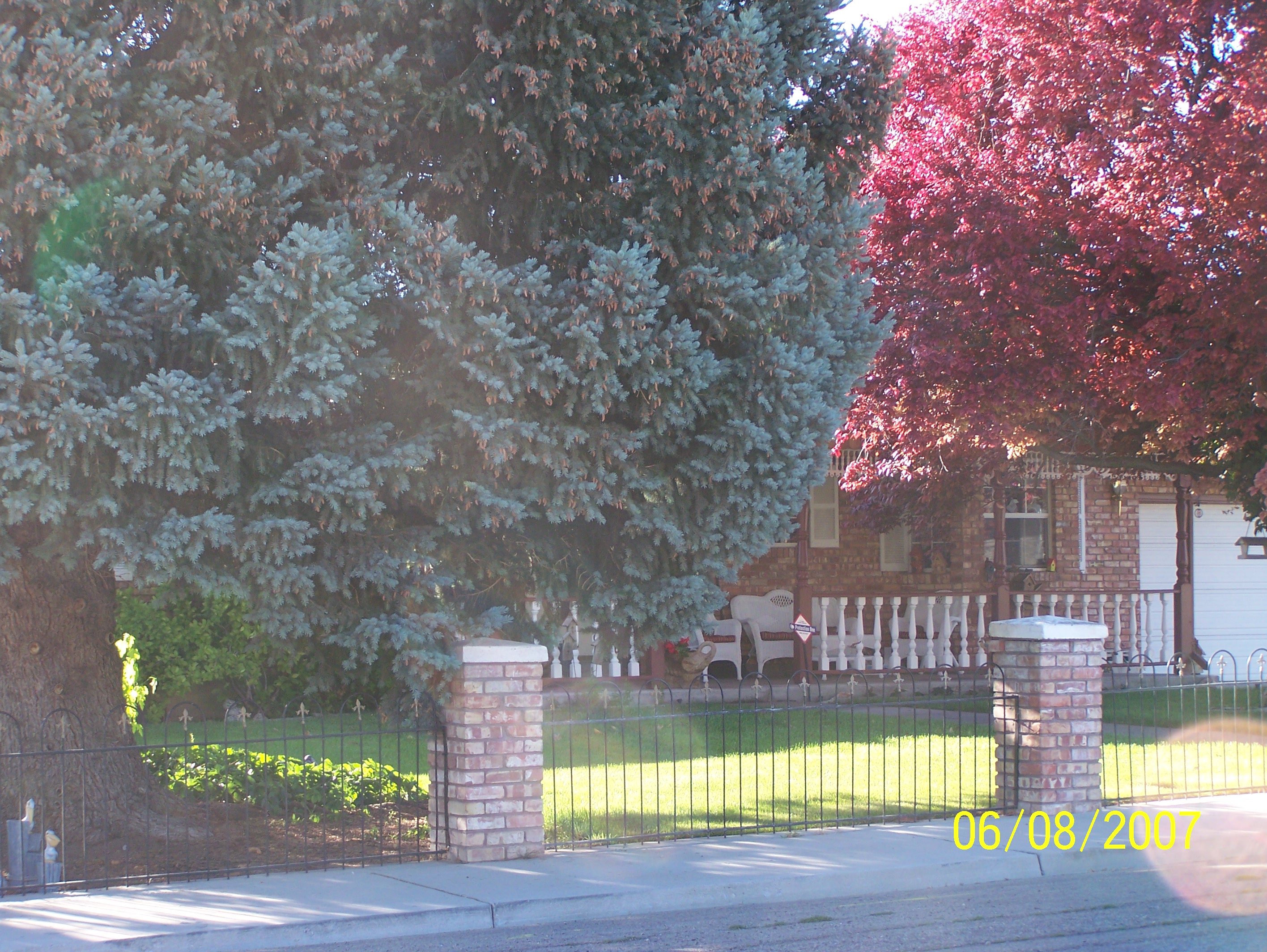 Total Photos: 2
|
| |
|
|
| Property Address: 475 S 400 EAST - PAYSON |
|
| Mailing Address: 475 S 400 E PAYSON, UT 84651-2531 |
|
| Acreage: 0.31 |
|
| Last Document:
892-1968
|
|
| Subdivision Map Filing |
|
| Taxing Description:
COM N 115.5 FT FR SW COR LOT 2, BLK 1, PLAT J, PAYSON; N 75 FT; E 181.5 FT; S 75 FT; W 181.5 FT TO BEG. ALSO COM N 115.5 FT FR SD SW COR; E 91.5 FT; S 10 FT; W 91.5 FT; N 10 FT TO BEG. AREA .33 ACRE.
*Taxing description NOT FOR LEGAL DOCUMENTS
|
|
- Owner Names
- Value History
- Tax History
- Location
- Photos
- Documents
- Aerial Image
| |
----- Real Estate Values ----- |
---Improvements--- |
---Greenbelt--- |
Total |
| Year |
Com |
Res |
Agr |
Tot |
Com |
Res |
Agr |
Tot |
Land |
Homesite |
Tot |
Market Value |
| 2024 |
$0 |
$111,200 |
$0 |
$111,200 |
$0 |
$475,400 |
$0 |
$475,400 |
$0 |
$0 |
$0 |
$586,600 |
| 2023 |
$0 |
$111,100 |
$0 |
$111,100 |
$0 |
$520,900 |
$0 |
$520,900 |
$0 |
$0 |
$0 |
$632,000 |
| 2022 |
$0 |
$118,500 |
$0 |
$118,500 |
$0 |
$604,500 |
$0 |
$604,500 |
$0 |
$0 |
$0 |
$723,000 |
| 2021 |
$0 |
$94,800 |
$0 |
$94,800 |
$0 |
$425,700 |
$0 |
$425,700 |
$0 |
$0 |
$0 |
$520,500 |
| 2020 |
$0 |
$86,200 |
$0 |
$86,200 |
$0 |
$402,400 |
$0 |
$402,400 |
$0 |
$0 |
$0 |
$488,600 |
| 2019 |
$0 |
$74,400 |
$0 |
$74,400 |
$0 |
$349,900 |
$0 |
$349,900 |
$0 |
$0 |
$0 |
$424,300 |
| 2018 |
$0 |
$62,700 |
$0 |
$62,700 |
$0 |
$304,300 |
$0 |
$304,300 |
$0 |
$0 |
$0 |
$367,000 |
| 2017 |
$0 |
$60,300 |
$0 |
$60,300 |
$0 |
$264,600 |
$0 |
$264,600 |
$0 |
$0 |
$0 |
$324,900 |
| 2016 |
$0 |
$54,800 |
$0 |
$54,800 |
$0 |
$230,100 |
$0 |
$230,100 |
$0 |
$0 |
$0 |
$284,900 |
| 2015 |
$0 |
$48,600 |
$0 |
$48,600 |
$0 |
$200,100 |
$0 |
$200,100 |
$0 |
$0 |
$0 |
$248,700 |
| 2014 |
$0 |
$47,000 |
$0 |
$47,000 |
$0 |
$200,100 |
$0 |
$200,100 |
$0 |
$0 |
$0 |
$247,100 |
| 2013 |
$0 |
$39,900 |
$0 |
$39,900 |
$0 |
$200,100 |
$0 |
$200,100 |
$0 |
$0 |
$0 |
$240,000 |
| 2012 |
$0 |
$39,200 |
$0 |
$39,200 |
$0 |
$221,300 |
$0 |
$221,300 |
$0 |
$0 |
$0 |
$260,500 |
| 2011 |
$0 |
$38,400 |
$0 |
$38,400 |
$0 |
$232,800 |
$0 |
$232,800 |
$0 |
$0 |
$0 |
$271,200 |
| 2010 |
$0 |
$36,200 |
$0 |
$36,200 |
$0 |
$252,087 |
$0 |
$252,087 |
$0 |
$0 |
$0 |
$288,287 |
| 2009 |
$0 |
$36,200 |
$0 |
$36,200 |
$0 |
$269,500 |
$0 |
$269,500 |
$0 |
$0 |
$0 |
$305,700 |
| 2008 |
$0 |
$36,200 |
$0 |
$36,200 |
$0 |
$291,700 |
$0 |
$291,700 |
$0 |
$0 |
$0 |
$327,900 |
| 2007 |
$0 |
$36,700 |
$0 |
$36,700 |
$0 |
$296,124 |
$0 |
$296,124 |
$0 |
$0 |
$0 |
$332,824 |
| 2006 |
$0 |
$31,900 |
$0 |
$31,900 |
$0 |
$261,000 |
$0 |
$261,000 |
$0 |
$0 |
$0 |
$292,900 |
| 2005 |
$0 |
$30,412 |
$0 |
$30,412 |
$0 |
$248,575 |
$0 |
$248,575 |
$0 |
$0 |
$0 |
$278,987 |
| 2004 |
$0 |
$30,412 |
$0 |
$30,412 |
$0 |
$248,575 |
$0 |
$248,575 |
$0 |
$0 |
$0 |
$278,987 |
| 2003 |
$0 |
$30,412 |
$0 |
$30,412 |
$0 |
$248,575 |
$0 |
$248,575 |
$0 |
$0 |
$0 |
$278,987 |
| 2002 |
$0 |
$30,412 |
$0 |
$30,412 |
$0 |
$248,575 |
$0 |
$248,575 |
$0 |
$0 |
$0 |
$278,987 |
| 2001 |
$0 |
$34,956 |
$0 |
$34,956 |
$0 |
$225,977 |
$0 |
$225,977 |
$0 |
$0 |
$0 |
$260,933 |
| 2000 |
$0 |
$32,669 |
$0 |
$32,669 |
$0 |
$211,292 |
$0 |
$211,292 |
$0 |
$0 |
$0 |
$243,961 |
| 1999 |
$0 |
$32,669 |
$0 |
$32,669 |
$0 |
$211,292 |
$0 |
$211,292 |
$0 |
$0 |
$0 |
$243,961 |
| 1998 |
$0 |
$32,669 |
$0 |
$32,669 |
$0 |
$211,292 |
$0 |
$211,292 |
$0 |
$0 |
$0 |
$243,961 |
| 1997 |
$0 |
$32,669 |
$0 |
$32,669 |
$0 |
$211,292 |
$0 |
$211,292 |
$0 |
$0 |
$0 |
$243,961 |
| 1996 |
$0 |
$28,944 |
$0 |
$28,944 |
$0 |
$187,199 |
$0 |
$187,199 |
$0 |
$0 |
$0 |
$216,143 |
| 1995 |
$0 |
$26,313 |
$0 |
$26,313 |
$0 |
$187,199 |
$0 |
$187,199 |
$0 |
$0 |
$0 |
$213,512 |
| 1994 |
$0 |
$15,388 |
$0 |
$15,388 |
$0 |
$150,967 |
$0 |
$150,967 |
$0 |
$0 |
$0 |
$166,355 |
| 1993 |
$0 |
$15,388 |
$0 |
$15,388 |
$0 |
$150,967 |
$0 |
$150,967 |
$0 |
$0 |
$0 |
$166,355 |
| 1992 |
$0 |
$14,117 |
$0 |
$14,117 |
$0 |
$130,177 |
$0 |
$130,177 |
$0 |
$0 |
$0 |
$144,294 |
| 1991 |
$0 |
$12,383 |
$0 |
$12,383 |
$0 |
$114,190 |
$0 |
$114,190 |
$0 |
$0 |
$0 |
$126,573 |
| 1990 |
$0 |
$12,383 |
$0 |
$12,383 |
$0 |
$113,878 |
$0 |
$113,878 |
$0 |
$0 |
$0 |
$126,261 |
| 1989 |
$0 |
$12,383 |
$0 |
$12,383 |
$0 |
$69,131 |
$0 |
$69,131 |
$0 |
$0 |
$0 |
$81,514 |
| 1988 |
$0 |
$12,383 |
$0 |
$12,383 |
$0 |
$86,653 |
$0 |
$86,653 |
$0 |
$0 |
$0 |
$99,036 |
| 1987 |
$0 |
$12,767 |
$0 |
$12,767 |
$0 |
$89,333 |
$0 |
$89,333 |
$0 |
$0 |
$0 |
$102,100 |
| 1986 |
$0 |
$12,767 |
$0 |
$12,767 |
$0 |
$89,335 |
$0 |
$89,335 |
$0 |
$0 |
$0 |
$102,102 |
| 1985 |
$0 |
$12,767 |
$0 |
$12,767 |
$0 |
$89,333 |
$0 |
$89,333 |
$0 |
$0 |
$0 |
$102,100 |
| 1984 |
$0 |
$12,892 |
$0 |
$12,892 |
$0 |
$90,233 |
$0 |
$90,233 |
$0 |
$0 |
$0 |
$103,125 |
| Year |
General Taxes |
Adjustments |
Net Taxes |
Fees |
Payments |
Tax Balance* |
Balance Due |
Tax District |
| 2025 |
$0.00 |
$0.00 |
$0.00 |
$0.00 |
|
$0.00
|
$0.00 |
170 - PAYSON CITY |
| 2024 |
$3,170.16 |
$0.00 |
$3,170.16 |
$0.00 |
|
$0.00
|
$0.00 |
170 - PAYSON CITY |
| 2023 |
$3,406.13 |
$0.00 |
$3,406.13 |
$0.00 |
|
$0.00
|
$0.00 |
170 - PAYSON CITY |
| 2022 |
$3,961.79 |
$0.00 |
$3,961.79 |
$0.00 |
|
$0.00
|
$0.00 |
170 - PAYSON CITY |
| 2021 |
$3,233.19 |
$0.00 |
$3,233.19 |
$0.00 |
|
$0.00
|
$0.00 |
170 - PAYSON CITY |
| 2020 |
$3,102.22 |
$0.00 |
$3,102.22 |
$0.00 |
|
$0.00
|
$0.00 |
170 - PAYSON CITY |
| 2019 |
$2,627.69 |
$0.00 |
$2,627.69 |
$0.00 |
|
$0.00
|
$0.00 |
170 - PAYSON CITY |
| 2018 |
$2,358.21 |
$0.00 |
$2,358.21 |
$0.00 |
|
$0.00
|
$0.00 |
170 - PAYSON CITY |
| 2017 |
$2,134.87 |
$0.00 |
$2,134.87 |
$0.00 |
|
$0.00
|
$0.00 |
170 - PAYSON CITY |
| 2016 |
$1,884.41 |
$0.00 |
$1,884.41 |
$0.00 |
|
$0.00
|
$0.00 |
170 - PAYSON CITY |
| 2015 |
$1,656.33 |
$0.00 |
$1,656.33 |
$0.00 |
|
$0.00
|
$0.00 |
170 - PAYSON CITY |
| 2014 |
$1,633.85 |
$0.00 |
$1,633.85 |
$0.00 |
|
$0.00
|
$0.00 |
170 - PAYSON CITY |
| 2013 |
$1,661.09 |
$0.00 |
$1,661.09 |
$0.00 |
|
$0.00
|
$0.00 |
170 - PAYSON CITY |
| 2012 |
$1,830.19 |
$0.00 |
$1,830.19 |
$0.00 |
|
$0.00
|
$0.00 |
170 - PAYSON CITY |
| 2011 |
$1,860.17 |
$0.00 |
$1,860.17 |
$0.00 |
|
$0.00
|
$0.00 |
170 - PAYSON CITY |
| 2010 |
$1,928.07 |
$0.00 |
$1,928.07 |
$0.00 |
|
$0.00
|
$0.00 |
170 - PAYSON CITY |
| 2009 |
$1,936.41 |
$0.00 |
$1,936.41 |
$0.00 |
|
$0.00
|
$0.00 |
170 - PAYSON CITY |
| 2008 |
$1,932.04 |
$0.00 |
$1,932.04 |
$0.00 |
|
$0.00
|
$0.00 |
170 - PAYSON CITY |
| 2007 |
$1,945.12 |
$0.00 |
$1,945.12 |
$0.00 |
|
$0.00
|
$0.00 |
170 - PAYSON CITY |
| 2006 |
$1,902.05 |
$0.00 |
$1,902.05 |
$0.00 |
|
$0.00
|
$0.00 |
170 - PAYSON CITY |
| 2005 |
$1,928.63 |
$0.00 |
$1,928.63 |
$0.00 |
|
$0.00
|
$0.00 |
170 - PAYSON CITY |
| 2004 |
$1,934.00 |
$0.00 |
$1,934.00 |
$0.00 |
|
$0.00
|
$0.00 |
170 - PAYSON CITY |
| 2003 |
$1,755.39 |
$0.00 |
$1,755.39 |
$0.00 |
|
$0.00
|
$0.00 |
170 - PAYSON CITY |
| 2002 |
$1,713.34 |
$0.00 |
$1,713.34 |
$0.00 |
|
$0.00
|
$0.00 |
170 - PAYSON CITY |
| 2001 |
$1,632.17 |
$0.00 |
$1,632.17 |
$0.00 |
|
$0.00
|
$0.00 |
170 - PAYSON CITY |
| 2000 |
$1,509.65 |
$0.00 |
$1,509.65 |
$0.00 |
|
$0.00
|
$0.00 |
170 - PAYSON CITY |
| 1999 |
$1,433.17 |
$0.00 |
$1,433.17 |
$0.00 |
|
$0.00
|
$0.00 |
170 - PAYSON CITY |
| 1998 |
$1,397.74 |
$0.00 |
$1,397.74 |
$0.00 |
|
$0.00
|
$0.00 |
170 - PAYSON CITY |
| 1997 |
$1,541.72 |
$0.00 |
$1,541.72 |
$0.00 |
|
$0.00
|
$0.00 |
170 - PAYSON CITY |
| 1996 |
$1,345.58 |
$0.00 |
$1,345.58 |
$0.00 |
|
$0.00
|
$0.00 |
170 - PAYSON CITY |
| 1995 |
$1,328.50 |
$0.00 |
$1,328.50 |
$0.00 |
|
$0.00
|
$0.00 |
170 - PAYSON CITY |
| 1994 |
$1,591.85 |
$0.00 |
$1,591.85 |
$0.00 |
|
$0.00
|
$0.00 |
170 - PAYSON CITY |
| 1993 |
$1,445.73 |
$0.00 |
$1,445.73 |
$0.00 |
|
$0.00
|
$0.00 |
170 - PAYSON CITY |
| 1992 |
$1,224.53 |
$0.00 |
$1,224.53 |
$0.00 |
|
$0.00
|
$0.00 |
170 - PAYSON CITY |
| 1991 |
$1,130.74 |
$0.00 |
$1,130.74 |
$0.00 |
|
$0.00
|
$0.00 |
170 - PAYSON CITY |
| 1990 |
$1,129.31 |
$0.00 |
$1,129.31 |
$0.00 |
|
$0.00
|
$0.00 |
170 - PAYSON CITY |
| 1989 |
$732.90 |
$0.00 |
$732.90 |
$0.00 |
|
$0.00
|
$0.00 |
170 - PAYSON CITY |
| 1988 |
$890.44 |
$0.00 |
$890.44 |
$0.00 |
|
$0.00
|
$0.00 |
170 - PAYSON CITY |
| 1987 |
$920.62 |
$0.00 |
$920.62 |
$0.00 |
|
$0.00
|
$0.00 |
170 - PAYSON CITY |
| 1986 |
$871.79 |
$0.00 |
$871.79 |
$0.00 |
|
$0.00
|
$0.00 |
170 - PAYSON CITY |
| 1985 |
$848.70 |
$0.00 |
$848.70 |
$0.00 |
|
$0.00
|
$0.00 |
170 - PAYSON CITY |
| 1984 |
$801.90 |
$0.00 |
$801.90 |
$0.00 |
|
$0.00
|
$0.00 |
170 - PAYSON CITY |
* Note: Original tax amount (Does not include applicable interest and/or fees).
| Entry # |
Date |
Recorded |
Type |
Party1 (Grantor) |
Party2 (Grantee) |
| 3187-2015 |
12/04/2014 |
01/14/2015 |
QCD |
UNITED STATES OF AMERICA |
SOUTH UTAH VALLEY ELECTRIC SERVICE DISTRICT |
| 31654-2014 |
03/21/2014 |
05/12/2014 |
D TR |
CARTER, LARRY DELL & NINA GAY TEE |
ZIONS FIRST NATIONAL BANK |
| 114949-2008 |
10/20/2008 |
10/22/2008 |
CT |
STATE OF UTAH |
WHOM OF INTEREST |
| 107508-2008 |
09/30/2008 |
09/30/2008 |
RESOL |
BOARD OF COUNTY COMMISSIONERS UTAH COUNTY |
WHOM OF INTEREST |
| 172146-2003 |
09/07/2003 |
10/27/2003 |
REC |
ZIONS FIRST NATIONAL BANK TEE |
CARTER, LARRY DELL & NINA GAY TEE |
| 126119-2002 |
10/19/2002 |
10/24/2002 |
QCD |
BROWN, WAYNE & MARY JEAN PTNR (ET AL) |
JENSEN, DARRELL W & AMIE B |
| 74017-1997 |
09/17/1997 |
09/22/1997 |
TR D |
CARTER, LARRY DELL & LARRY DELL (ET AL) |
ZIONS FIRST NATIONAL BANK |
| 1143-1993 |
12/23/1992 |
01/07/1993 |
WD |
CARTER, LARRY D & LARRY DELL |
CARTER, LARRY DELL & NINA GAY TEE |
| 24219-1989 |
08/15/1989 |
08/22/1989 |
SP WD |
DURRANT, MARY LOU H |
CARTER, LARRY D |
| 23822-1987 |
06/03/1987 |
06/18/1987 |
REL |
COMMONWEALTH WESTERN MORTGAGE CORPORATION |
CARTER, LARRY DELL & NINA G |
| 20120-1987 |
04/10/1987 |
05/22/1987 |
AS |
COMMONWEALTH MORTGAGE CORPORATION OF AMERICA SUC TO (ET AL) |
COMMONWEALTH MORTGAGE COMPANY OF AMERICA |
Main Menu Comments or Concerns on Value/Appraisal - Assessor's Office
Documents/Owner/Parcel information - Recorder's Office
Address Change for Tax Notice
This page was created on 4/6/2025 12:25:41 PM |
