Property Information
mobile view
| Serial Number: 08:092:0012 |
Serial Life: 1993-2002 |
|
|
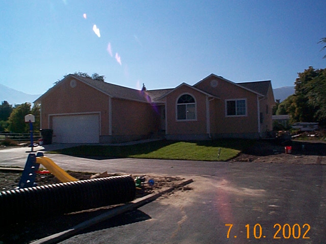 Total Photos: 1
|
| |
|
|
| Property Address: |
|
| Mailing Address: 353 W 400 N PAYSON, UT 84651-1410 |
|
| Acreage: 0.570739 |
|
| Last Document:
10195-2000
|
|
| Subdivision Map Filing |
|
| Taxing Description:
COM & S 165 FT FR NW COR. LOT 5, BLK 7, PLAT N, PAYSON CITY SURVEY; E 123 FT; S 202.125 FT; W 123 FT; N 202.125 FT TO BEG. AREA 0.571 AC.
*Taxing description NOT FOR LEGAL DOCUMENTS
|
|
- Owner Names
- Value History
- Tax History
- Location
- Photos
- Documents
- Aerial Image
| |
----- Real Estate Values ----- |
---Improvements--- |
---Greenbelt--- |
Total |
| Year |
Com |
Res |
Agr |
Tot |
Com |
Res |
Agr |
Tot |
Land |
Homesite |
Tot |
Market Value |
| 2002 |
$0 |
$11,048 |
$0 |
$11,048 |
$0 |
$0 |
$0 |
$0 |
$0 |
$0 |
$0 |
$11,048 |
| 2001 |
$0 |
$12,699 |
$0 |
$12,699 |
$0 |
$0 |
$0 |
$0 |
$0 |
$0 |
$0 |
$12,699 |
| 2000 |
$0 |
$11,868 |
$0 |
$11,868 |
$0 |
$0 |
$0 |
$0 |
$0 |
$0 |
$0 |
$11,868 |
| 1999 |
$0 |
$11,868 |
$0 |
$11,868 |
$0 |
$0 |
$0 |
$0 |
$0 |
$0 |
$0 |
$11,868 |
| 1998 |
$0 |
$11,868 |
$0 |
$11,868 |
$0 |
$0 |
$0 |
$0 |
$0 |
$0 |
$0 |
$11,868 |
| 1997 |
$0 |
$11,868 |
$0 |
$11,868 |
$0 |
$0 |
$0 |
$0 |
$0 |
$0 |
$0 |
$11,868 |
| 1996 |
$0 |
$11,686 |
$0 |
$11,686 |
$0 |
$0 |
$0 |
$0 |
$0 |
$0 |
$0 |
$11,686 |
| 1995 |
$0 |
$10,624 |
$0 |
$10,624 |
$0 |
$0 |
$0 |
$0 |
$0 |
$0 |
$0 |
$10,624 |
| 1994 |
$0 |
$6,213 |
$0 |
$6,213 |
$0 |
$0 |
$0 |
$0 |
$0 |
$0 |
$0 |
$6,213 |
| 1993 |
$0 |
$6,213 |
$0 |
$6,213 |
$0 |
$0 |
$0 |
$0 |
$0 |
$0 |
$0 |
$6,213 |
| Year |
General Taxes |
Adjustments |
Net Taxes |
Fees |
Payments |
Tax Balance* |
Balance Due |
Tax District |
| 2002 |
$67.84 |
$0.00 |
$67.84 |
$0.00 |
|
$0.00
|
$0.00 |
170 - PAYSON CITY |
| 2001 |
$79.43 |
$0.00 |
$79.43 |
$0.00 |
|
$0.00
|
$0.00 |
170 - PAYSON CITY |
| 2000 |
$73.44 |
$0.00 |
$73.44 |
$0.00 |
|
$0.00
|
$0.00 |
170 - PAYSON CITY |
| 1999 |
$69.71 |
$0.00 |
$69.71 |
$0.00 |
|
$0.00
|
$0.00 |
170 - PAYSON CITY |
| 1998 |
$67.99 |
$0.00 |
$67.99 |
$0.00 |
|
$0.00
|
$0.00 |
170 - PAYSON CITY |
| 1997 |
$75.00 |
$0.00 |
$75.00 |
$0.00 |
|
$0.00
|
$0.00 |
170 - PAYSON CITY |
| 1996 |
$132.27 |
$0.00 |
$132.27 |
$0.00 |
|
$0.00
|
$0.00 |
170 - PAYSON CITY |
| 1995 |
$120.19 |
$0.00 |
$120.19 |
$0.00 |
|
$0.00
|
$0.00 |
170 - PAYSON CITY |
| 1994 |
$87.43 |
$0.00 |
$87.43 |
$0.00 |
|
$0.00
|
$0.00 |
170 - PAYSON CITY |
| 1993 |
$76.58 |
$0.00 |
$76.58 |
$0.00 |
|
$0.00
|
$0.00 |
170 - PAYSON CITY |
* Note: Original tax amount (Does not include applicable interest and/or fees).
| Entry # |
Date |
Recorded |
Type |
Party1 (Grantor) |
Party2 (Grantee) |
| 38353-2002 |
03/20/2002 |
04/05/2002 |
WD |
WOOLSEY, LARS MAHLON TEE (ET AL) |
WOOLSEY, RONALD G & SHANA M |
| 38352-2002 |
04/01/2002 |
04/05/2002 |
D TR |
WOOLSEY, RONALD G & SHANA M |
BANK OF AMERICAN FORK |
| 38351-2002 |
03/20/2002 |
04/05/2002 |
EAS |
WOOLSEY, LARS MAHLON TEE (ET AL) |
PAYSON CITY |
| 38350-2002 |
03/20/2002 |
04/05/2002 |
QCD |
WOOLSEY, LARS MAHLON TEE (ET AL) |
WOOLSEY, RONALD G & SHANA M |
| 38349-2002 |
04/02/2002 |
04/05/2002 |
AF DC |
WOOLSEY, PHYLLIS C & PHYLLIS COLLEEN AKA (ET AL) |
WHOM OF INTEREST |
| 10195-2000 |
01/28/2000 |
02/07/2000 |
QCD |
WOOLSEY, LARS M & PHYLLIS C (ET AL) |
WOOLSEY, LARS MAHLON & PHYLLIS COLLEEN TEE |
| 57126-1992 |
10/26/1992 |
10/26/1992 |
WD |
ENGLISH, BONNIE O'LEARY & DON C (ET AL) |
WOOLSEY, LARS M & PHYLLIS COLLEEN |
Main Menu Comments or Concerns on Value/Appraisal - Assessor's Office
Documents/Owner/Parcel information - Recorder's Office
Address Change for Tax Notice
This page was created on 4/23/2025 3:28:48 AM |