Property Information
mobile view
| Serial Number: 09:112:0001 |
Serial Life: 1981... |
|
|
 Total Photos: 2
|
| |
|
|
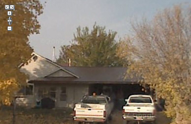
| Property Address: 285 E 300 NORTH - SANTAQUIN |
|
| Mailing Address: 345 N 300 E SANTAQUIN, UT 84655-7117 |
|
| Acreage: 0.84 |
|
| Last Document:
36991-1980
|
|
| Subdivision Map Filing |
|
| Taxing Description:
COM SE COR LOT 1, BLK 51, PLAT B, SANTAQUIN; N 97.5 FT; W 120 FT; N 70 FT; W 41 FT; N 80 FT; W 80.5 FT; S 80 FT; E 80 FT; S 167.5 FT; E 161.5 FT M OR L TO BEG. AREA .58 ACRE.
*Taxing description NOT FOR LEGAL DOCUMENTS
|
|
- Owner Names
- Value History
- Tax History
- Location
- Photos
- Documents
- Aerial Image
| 2015... |
|
JOHNSON, LANA C |
|
| 2015... |
|
JOHNSON, RICHARD D |
|
| 1996-2014 |
|
JOHNSON, MARK E |
|
| 1996-2014 |
|
JOHNSON, SHIRLEY R |
|
| 1988-1995 |
|
JOHNSON, MARK E |
|
| 1988-1995 |
|
JOHNSON, SHIRLEY R |
|
| 1984-1987 |
|
JOHNSON, MARK E |
|
| 1984-1987 |
|
JOHNSON, SHIRLEY R |
|
| 1983 |
|
JOHNSON, MARK E |
|
| 1983 |
|
JOHNSON, SHIRLEY R |
|
| 1981-1982 |
|
JOHNSON, MARK E |
|
| 1981-1982 |
|
JOHNSON, SHIRLEY R |
|
| |
----- Real Estate Values ----- |
---Improvements--- |
---Greenbelt--- |
Total |
| Year |
Com |
Res |
Agr |
Tot |
Com |
Res |
Agr |
Tot |
Land |
Homesite |
Tot |
Market Value |
| 2024 |
$0 |
$155,000 |
$0 |
$155,000 |
$0 |
$136,900 |
$0 |
$136,900 |
$0 |
$0 |
$0 |
$291,900 |
| 2023 |
$0 |
$154,900 |
$0 |
$154,900 |
$0 |
$138,300 |
$0 |
$138,300 |
$0 |
$0 |
$0 |
$293,200 |
| 2022 |
$0 |
$165,200 |
$0 |
$165,200 |
$0 |
$121,700 |
$0 |
$121,700 |
$0 |
$0 |
$0 |
$286,900 |
| 2021 |
$0 |
$91,800 |
$0 |
$91,800 |
$0 |
$99,700 |
$0 |
$99,700 |
$0 |
$0 |
$0 |
$191,500 |
| 2020 |
$0 |
$79,800 |
$0 |
$79,800 |
$0 |
$94,500 |
$0 |
$94,500 |
$0 |
$0 |
$0 |
$174,300 |
| 2019 |
$0 |
$75,400 |
$0 |
$75,400 |
$0 |
$94,500 |
$0 |
$94,500 |
$0 |
$0 |
$0 |
$169,900 |
| 2018 |
$0 |
$71,000 |
$0 |
$71,000 |
$0 |
$82,200 |
$0 |
$82,200 |
$0 |
$0 |
$0 |
$153,200 |
| 2017 |
$0 |
$71,000 |
$0 |
$71,000 |
$0 |
$71,500 |
$0 |
$71,500 |
$0 |
$0 |
$0 |
$142,500 |
| 2016 |
$0 |
$53,200 |
$0 |
$53,200 |
$0 |
$71,500 |
$0 |
$71,500 |
$0 |
$0 |
$0 |
$124,700 |
| 2015 |
$0 |
$51,400 |
$0 |
$51,400 |
$0 |
$62,200 |
$0 |
$62,200 |
$0 |
$0 |
$0 |
$113,600 |
| 2014 |
$0 |
$50,600 |
$0 |
$50,600 |
$0 |
$62,200 |
$0 |
$62,200 |
$0 |
$0 |
$0 |
$112,800 |
| 2013 |
$0 |
$37,100 |
$0 |
$37,100 |
$0 |
$62,200 |
$0 |
$62,200 |
$0 |
$0 |
$0 |
$99,300 |
| 2012 |
$0 |
$37,100 |
$0 |
$37,100 |
$0 |
$60,900 |
$0 |
$60,900 |
$0 |
$0 |
$0 |
$98,000 |
| 2011 |
$0 |
$37,100 |
$0 |
$37,100 |
$0 |
$66,600 |
$0 |
$66,600 |
$0 |
$0 |
$0 |
$103,700 |
| 2010 |
$0 |
$41,058 |
$0 |
$41,058 |
$0 |
$73,773 |
$0 |
$73,773 |
$0 |
$0 |
$0 |
$114,831 |
| 2009 |
$0 |
$61,900 |
$0 |
$61,900 |
$0 |
$58,600 |
$0 |
$58,600 |
$0 |
$0 |
$0 |
$120,500 |
| 2008 |
$0 |
$61,900 |
$0 |
$61,900 |
$0 |
$53,000 |
$0 |
$53,000 |
$0 |
$0 |
$0 |
$114,900 |
| 2007 |
$0 |
$46,600 |
$0 |
$46,600 |
$0 |
$74,400 |
$0 |
$74,400 |
$0 |
$0 |
$0 |
$121,000 |
| 2006 |
$0 |
$46,600 |
$0 |
$46,600 |
$0 |
$47,400 |
$0 |
$47,400 |
$0 |
$0 |
$0 |
$94,000 |
| 2005 |
$0 |
$44,364 |
$0 |
$44,364 |
$0 |
$45,133 |
$0 |
$45,133 |
$0 |
$0 |
$0 |
$89,497 |
| 2004 |
$0 |
$44,364 |
$0 |
$44,364 |
$0 |
$45,133 |
$0 |
$45,133 |
$0 |
$0 |
$0 |
$89,497 |
| 2003 |
$0 |
$44,364 |
$0 |
$44,364 |
$0 |
$45,133 |
$0 |
$45,133 |
$0 |
$0 |
$0 |
$89,497 |
| 2002 |
$0 |
$44,364 |
$0 |
$44,364 |
$0 |
$45,133 |
$0 |
$45,133 |
$0 |
$0 |
$0 |
$89,497 |
| 2001 |
$0 |
$44,364 |
$0 |
$44,364 |
$0 |
$45,133 |
$0 |
$45,133 |
$0 |
$0 |
$0 |
$89,497 |
| 2000 |
$0 |
$41,462 |
$0 |
$41,462 |
$0 |
$39,273 |
$0 |
$39,273 |
$0 |
$0 |
$0 |
$80,735 |
| 1999 |
$0 |
$41,462 |
$0 |
$41,462 |
$0 |
$39,273 |
$0 |
$39,273 |
$0 |
$0 |
$0 |
$80,735 |
| 1998 |
$0 |
$41,462 |
$0 |
$41,462 |
$0 |
$39,273 |
$0 |
$39,273 |
$0 |
$0 |
$0 |
$80,735 |
| 1997 |
$0 |
$41,462 |
$0 |
$41,462 |
$0 |
$39,273 |
$0 |
$39,273 |
$0 |
$0 |
$0 |
$80,735 |
| 1996 |
$0 |
$32,372 |
$0 |
$32,372 |
$0 |
$30,663 |
$0 |
$30,663 |
$0 |
$0 |
$0 |
$63,035 |
| 1995 |
$0 |
$29,429 |
$0 |
$29,429 |
$0 |
$30,663 |
$0 |
$30,663 |
$0 |
$0 |
$0 |
$60,092 |
| 1994 |
$0 |
$17,210 |
$0 |
$17,210 |
$0 |
$24,728 |
$0 |
$24,728 |
$0 |
$0 |
$0 |
$41,938 |
| 1993 |
$0 |
$17,210 |
$0 |
$17,210 |
$0 |
$24,728 |
$0 |
$24,728 |
$0 |
$0 |
$0 |
$41,938 |
| 1992 |
$0 |
$15,789 |
$0 |
$15,789 |
$0 |
$22,686 |
$0 |
$22,686 |
$0 |
$0 |
$0 |
$38,475 |
| 1991 |
$0 |
$13,850 |
$0 |
$13,850 |
$0 |
$19,900 |
$0 |
$19,900 |
$0 |
$0 |
$0 |
$33,750 |
| 1990 |
$0 |
$13,850 |
$0 |
$13,850 |
$0 |
$19,900 |
$0 |
$19,900 |
$0 |
$0 |
$0 |
$33,750 |
| 1989 |
$0 |
$13,850 |
$0 |
$13,850 |
$0 |
$19,900 |
$0 |
$19,900 |
$0 |
$0 |
$0 |
$33,750 |
| 1988 |
$0 |
$13,850 |
$0 |
$13,850 |
$0 |
$19,900 |
$0 |
$19,900 |
$0 |
$0 |
$0 |
$33,750 |
| 1987 |
$0 |
$16,733 |
$0 |
$16,733 |
$0 |
$17,775 |
$0 |
$17,775 |
$0 |
$0 |
$0 |
$34,508 |
| 1986 |
$0 |
$16,734 |
$0 |
$16,734 |
$0 |
$17,775 |
$0 |
$17,775 |
$0 |
$0 |
$0 |
$34,509 |
| 1985 |
$0 |
$16,733 |
$0 |
$16,733 |
$0 |
$17,775 |
$0 |
$17,775 |
$0 |
$0 |
$0 |
$34,508 |
| 1984 |
$0 |
$16,900 |
$0 |
$16,900 |
$0 |
$18,933 |
$0 |
$18,933 |
$0 |
$0 |
$0 |
$35,833 |
| Year |
General Taxes |
Adjustments |
Net Taxes |
Fees |
Payments |
Tax Balance* |
Balance Due |
Tax District |
| 2025 |
$0.00 |
$0.00 |
$0.00 |
$0.00 |
|
$0.00
|
$0.00 |
190 - SANTAQUIN CITY |
| 2024 |
$1,612.19 |
$0.00 |
$1,612.19 |
$0.00 |
|
$0.00
|
$0.00 |
190 - SANTAQUIN CITY |
| 2023 |
$1,614.21 |
$0.00 |
$1,614.21 |
$0.00 |
|
$0.00
|
$0.00 |
190 - SANTAQUIN CITY |
| 2022 |
$1,531.40 |
$0.00 |
$1,531.40 |
$0.00 |
|
$0.00
|
$0.00 |
190 - SANTAQUIN CITY |
| 2021 |
$1,198.91 |
$0.00 |
$1,198.91 |
$0.00 |
|
$0.00
|
$0.00 |
190 - SANTAQUIN CITY |
| 2020 |
$1,126.13 |
$0.00 |
$1,126.13 |
$0.00 |
|
$0.00
|
$0.00 |
190 - SANTAQUIN CITY |
| 2019 |
$1,073.40 |
$0.00 |
$1,073.40 |
$0.00 |
|
$0.00
|
$0.00 |
190 - SANTAQUIN CITY |
| 2018 |
$1,015.08 |
$0.00 |
$1,015.08 |
$0.00 |
|
$0.00
|
$0.00 |
190 - SANTAQUIN CITY |
| 2017 |
$971.93 |
$0.00 |
$971.93 |
$0.00 |
|
$0.00
|
$0.00 |
190 - SANTAQUIN CITY |
| 2016 |
$868.01 |
$0.00 |
$868.01 |
$0.00 |
|
$0.00
|
$0.00 |
190 - SANTAQUIN CITY |
| 2015 |
$806.24 |
$0.00 |
$806.24 |
$0.00 |
|
$0.00
|
$0.00 |
190 - SANTAQUIN CITY |
| 2014 |
$802.18 |
$0.00 |
$802.18 |
$0.00 |
|
$0.00
|
$0.00 |
190 - SANTAQUIN CITY |
| 2013 |
$744.89 |
$0.00 |
$744.89 |
$0.00 |
|
$0.00
|
$0.00 |
190 - SANTAQUIN CITY |
| 2012 |
$712.07 |
$0.00 |
$712.07 |
$0.00 |
|
$0.00
|
$0.00 |
190 - SANTAQUIN CITY |
| 2011 |
$740.20 |
$0.00 |
$740.20 |
$0.00 |
|
$0.00
|
$0.00 |
190 - SANTAQUIN CITY |
| 2010 |
$793.57 |
$0.00 |
$793.57 |
$0.00 |
|
$0.00
|
$0.00 |
190 - SANTAQUIN CITY |
| 2009 |
$787.02 |
$0.00 |
$787.02 |
$0.00 |
|
$0.00
|
$0.00 |
190 - SANTAQUIN CITY |
| 2008 |
$693.57 |
$0.00 |
$693.57 |
$0.00 |
|
$0.00
|
$0.00 |
190 - SANTAQUIN CITY |
| 2007 |
$724.60 |
$0.00 |
$724.60 |
$0.00 |
|
$0.00
|
$0.00 |
190 - SANTAQUIN CITY |
| 2006 |
$630.64 |
$0.00 |
$630.64 |
$0.00 |
|
$0.00
|
$0.00 |
190 - SANTAQUIN CITY |
| 2005 |
$637.59 |
$0.00 |
$637.59 |
$0.00 |
|
$0.00
|
$0.00 |
190 - SANTAQUIN CITY |
| 2004 |
$639.21 |
$0.00 |
$639.21 |
$0.00 |
|
$0.00
|
$0.00 |
190 - SANTAQUIN CITY |
| 2003 |
$581.57 |
$0.00 |
$581.57 |
$0.00 |
|
$0.00
|
$0.00 |
190 - SANTAQUIN CITY |
| 2002 |
$568.33 |
$0.00 |
$568.33 |
$0.00 |
|
$0.00
|
$0.00 |
190 - SANTAQUIN CITY |
| 2001 |
$571.92 |
$0.00 |
$571.92 |
$0.00 |
|
$0.00
|
$0.00 |
190 - SANTAQUIN CITY |
| 2000 |
$512.42 |
$0.00 |
$512.42 |
$0.00 |
|
$0.00
|
$0.00 |
190 - SANTAQUIN CITY |
| 1999 |
$485.91 |
$0.00 |
$485.91 |
$0.00 |
|
$0.00
|
$0.00 |
190 - SANTAQUIN CITY |
| 1998 |
$473.88 |
$0.00 |
$473.88 |
$0.00 |
|
$0.00
|
$0.00 |
190 - SANTAQUIN CITY |
| 1997 |
$514.69 |
$0.00 |
$514.69 |
$0.00 |
|
$0.00
|
$0.00 |
190 - SANTAQUIN CITY |
| 1996 |
$395.90 |
$0.00 |
$395.90 |
$0.00 |
|
$0.00
|
$0.00 |
190 - SANTAQUIN CITY |
| 1995 |
$378.70 |
$0.00 |
$378.70 |
$0.00 |
|
$0.00
|
$0.00 |
190 - SANTAQUIN CITY |
| 1994 |
$408.09 |
$0.00 |
$408.09 |
$0.00 |
|
$0.00
|
$0.00 |
190 - SANTAQUIN CITY |
| 1993 |
$372.84 |
$0.00 |
$372.84 |
$0.00 |
|
$0.00
|
$0.00 |
190 - SANTAQUIN CITY |
| 1992 |
$334.03 |
$0.00 |
$334.03 |
$0.00 |
|
$0.00
|
$0.00 |
190 - SANTAQUIN CITY |
| 1991 |
$313.13 |
$0.00 |
$313.13 |
$0.00 |
|
$0.00
|
$0.00 |
190 - SANTAQUIN CITY |
| 1990 |
$308.02 |
$0.00 |
$308.02 |
$0.00 |
|
$0.00
|
$0.00 |
190 - SANTAQUIN CITY |
| 1989 |
$317.78 |
$0.00 |
$317.78 |
$0.00 |
|
$0.00
|
$0.00 |
190 - SANTAQUIN CITY |
| 1988 |
$317.68 |
$0.00 |
$317.68 |
$0.00 |
|
$0.00
|
$0.00 |
190 - SANTAQUIN CITY |
| 1987 |
$321.53 |
$0.00 |
$321.53 |
$0.00 |
|
$0.00
|
$0.00 |
190 - SANTAQUIN CITY |
| 1986 |
$309.73 |
$0.00 |
$309.73 |
$0.00 |
|
$0.00
|
$0.00 |
190 - SANTAQUIN CITY |
| 1985 |
$306.85 |
$0.00 |
$306.85 |
$0.00 |
|
$0.00
|
$0.00 |
190 - SANTAQUIN CITY |
| 1984 |
$303.54 |
$0.00 |
$303.54 |
$0.00 |
|
$0.00
|
$0.00 |
190 - SANTAQUIN CITY |
* Note: Original tax amount (Does not include applicable interest and/or fees).
| Entry # |
Date |
Recorded |
Type |
Party1 (Grantor) |
Party2 (Grantee) |
| 31436-2014 |
|
05/09/2014 |
QCD |
NEWTON, LISA C SUCTEE (ET AL) |
JOHNSON, RICHARD D & LANA C |
| 114949-2008 |
10/20/2008 |
10/22/2008 |
CT |
STATE OF UTAH |
WHOM OF INTEREST |
| 107508-2008 |
09/30/2008 |
09/30/2008 |
RESOL |
BOARD OF COUNTY COMMISSIONERS UTAH COUNTY |
WHOM OF INTEREST |
| 72904-2007 |
05/14/2007 |
05/17/2007 |
CT |
STATE OF UTAH |
WHOM OF INTEREST |
| 20210-1995 |
03/31/1995 |
04/03/1995 |
QCD |
JOHNSON, MARK E & SHIRLEY R |
JOHNSON, MARK E & SHIRLEY R TEE |
| 36865-1987 |
06/26/1987 |
09/30/1987 |
WD |
JOHNSON, MARK E & SHIRLEY R |
JOHNSON, RICHARD D & LANA C |
| 11199-1983 |
03/09/1983 |
04/19/1983 |
SP WD |
JOHNSON, MARK E & SHIRLEY R |
JOHNSON, CHRIS K & KATHRYN E |
| 8378-1983 |
03/09/1983 |
03/28/1983 |
SP WD |
JOHNSON, MARK E & SHIRLEY R |
JOHNSON, CHRIS K & KATHRYN E |
| 6201-1983 |
01/28/1983 |
03/07/1983 |
SP WD |
JOHNSON, MARK E & SHIRLEY R |
JOHNSON, CHRIS K & KATHRYN E |
| 4412-1983 |
01/29/1983 |
02/16/1983 |
QCD |
BUTLER, JUNIOR A & MYRLE C |
BUTLER, BURYL DUANE & FLORENCE W |
| 4411-1983 |
01/29/1983 |
02/16/1983 |
QCD |
BUTLER, NYE ROYD & DIANE K |
BUTLER, BURYL DUANE & FLORENCE W |
| 4410-1983 |
01/29/1983 |
02/16/1983 |
QCD |
BUTLER, KELLY TAYLOR & KATHERINE H |
BUTLER, BURYL DUANE & FLORENCE W |
| 4409-1983 |
01/29/1983 |
02/16/1983 |
QCD |
BUTLER, HEBER DALE & HEBER D AKA (ET AL) |
BUTLER, BURYL DUANE & FLORENCE W |
| 4408-1983 |
02/14/1983 |
02/16/1983 |
AF |
BUTLER, NELS & MARTHA ANN DEC |
BUTLER, HEBER DALE & KELLY TAYLOR |
| 36991-1980 |
10/23/1980 |
10/23/1980 |
WD |
JOHNSON, MARK E & SHIRLEY R |
JOHNSON, RICHARD D & LANA C |
Main Menu Comments or Concerns on Value/Appraisal - Assessor's Office
Documents/Owner/Parcel information - Recorder's Office
Address Change for Tax Notice
This page was created on 4/6/2025 1:50:16 PM |
